- Couple accused of creating videos of young girls using hidden cameras at The Woodlands Mall, Hurricane Harbor
- Couple accused of creating videos with hidden cameras at The Woodlands Mall, Hurricane Harbor
- The Texanist: Texas Gets More Tornadoes Than Any Other State, but Don’t Freak Out
- U.S. Supreme Court says Texans can sue state for flood damage
- This is how many hurricanes NC State researchers predict this year
Texas, Oklahoma Prepare For Another Round Of Severe Weather
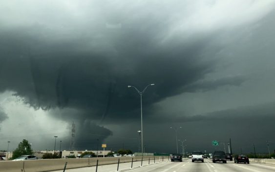
OKLAHOMA CITY (CBSDFW.COM/AP) — Another round of severe weather is forecast for Texas, Oklahoma and parts of the Southern Plains, including the possibility of tornadoes.
CBS 11 Meteorologist Jeff Ray is forecasting a significant severe weather outbreak today across the Oklahoma/Texas Panhandle. He says the system will likely develop an overnight squall line that moves into counties in North Texas by midnight, hitting the Metroplex Tuesday morning and midday.
The line of storms moving across North Texas overnight and Tuesday bring the threat of damaging winds and hail. There is a low tornado threat, but flash flooding is possible.
School districts in Oklahoma City, nearby Norman and elsewhere have canceled classes Monday as forecasts also call for hail and wind gusts of up to 80 mph. A flood watch is in effect for the greater Oklahoma City region. Strong winds and hail also are forecast for the West Texas.
The National Weather Service says the storm system will move later Monday into western Arkansas. The threat of severe weather will continue into Tuesday.
It’s the latest round of severe weather to strike the region after a spate of tornadoes raked the Southern Plains on Friday and Saturday, leaving widespread damage and some people injured.
(© Copyright 2019 CBS Broadcasting Inc. All Rights Reserved. The Associated Press contributed to this report.)