- Wildfire that sparked west of Fredericksburg now fully contained
- Travis County launches F.L.A.M.E. initiative to combat wildfire risk for homeowners
- Crews making progress to contain wildfire in rural area west of Fredericksburg
- Wildfire in rural area west of Fredericksburg now entirely contained
- Crews battle wildfire in rural area west of Fredericksburg
Another stormy day brings risks of flooding, lightning strikes to Raleigh

Raleigh, N.C. — After slow-moving storms passed through the Triangle on Thursday, more severe weather is possible Friday.
Thursday’s weather included heavy downpours and lightning, leading to flooding, power outages and delayed flights out of Raleigh-Durham International Airport.
Communication lines connected to the Knightdale Community Pool were struck by lightning Thursday afternoon, severing the pool’s ability to place landline phone calls, including 911 calls, town officials said. That prompted officials to order the pool’s closure until it was fixed.
About 1.5 inches of rain fell in Raleigh, and 2 inches of rain fell in Fayetteville.
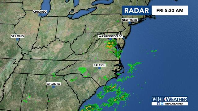
Lingering rain was moving out of central North Carolina on Friday morning and should be out of the area by lunchtime.
Skies will stay cloudy throughout the day, though, WRAL meteorologist Elizabeth Gardner said.
Storms are expected to redevelop around 5 p.m. and stick around through most of the night.
Heavy rain and frequent lightning are possible.
If the storms again move slowly, localized flooding is possible.
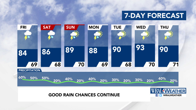
The threat for thunderstorms continues through most of next week.
They’ll bring cooler temperatures, as highs stay in the 80s throughout the weekend.

