- Couple accused of creating videos of young girls using hidden cameras at The Woodlands Mall, Hurricane Harbor
- Couple accused of creating videos with hidden cameras at The Woodlands Mall, Hurricane Harbor
- The Texanist: Texas Gets More Tornadoes Than Any Other State, but Don’t Freak Out
- U.S. Supreme Court says Texans can sue state for flood damage
- This is how many hurricanes NC State researchers predict this year
Wind, hail and isolated tornadoes possible Friday
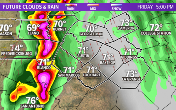
AUSTIN, Texas — Over the next 12 to 24 hours, conditions will align themselves towards an active evening of strong to severe thunderstorms for Central Texas. A strong frontal system is expected to reach our Hill Country residents mid-to-late afternoon before approaching the IH-35 corridor around dinner time.
Here’s a look at the timeline and the side effects of this system.

KVUE
RELATED:
Allergy Alert: Cedar pollen remains very high in Central Texas
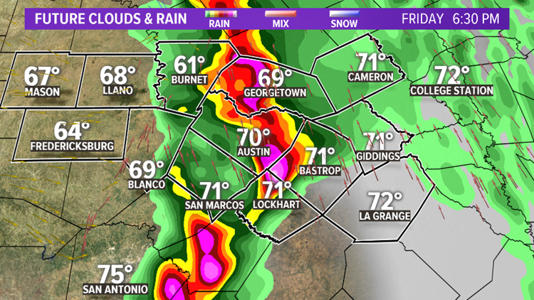
Some associated pop-up storms are likely ahead of the front with locally heavy downpours and gusts exceeding 60 mph.

KVUE
Loose lawn items could become projectiles with the gusty winds as the front moves eastward so it’s important to secure those items. Additionally, hail cores 1 to 2 inches in diameter are also possible.

kvue
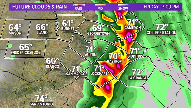
Key indicators of strengthening and rotation to look our for will be a bowing in the line of storms. Discrete supercells could cause some spin ups ahead of the front which could heighten our threat. As of now, the threat for tornadoes remains low.

KVUE
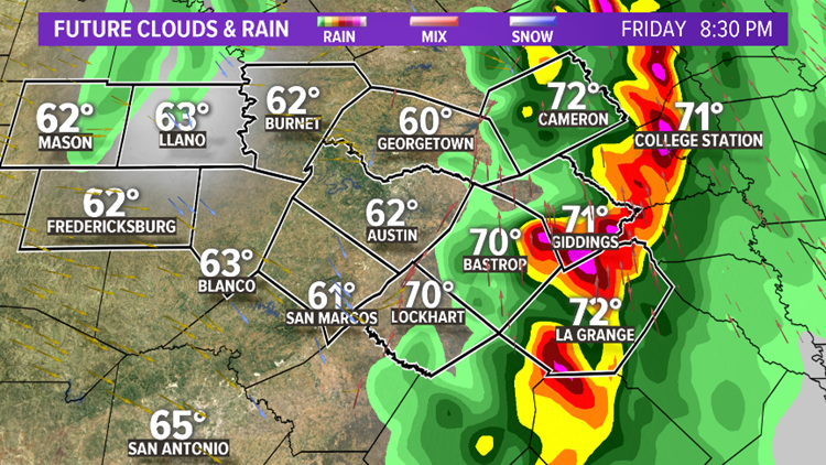
However, well after sunset, our eastern counties will still need to remain vigilant and weather aware.
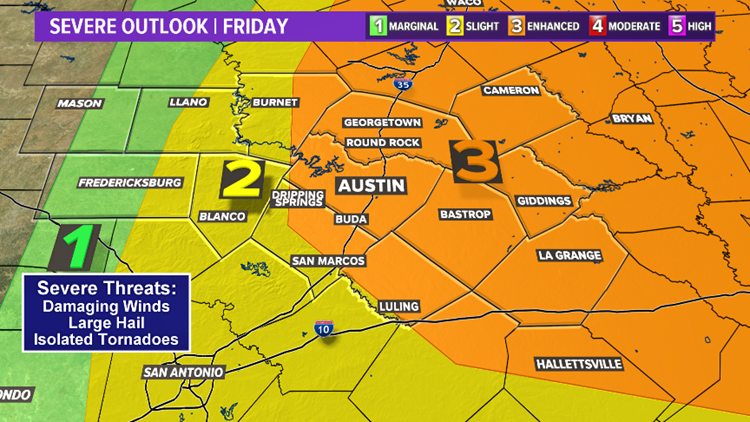
The Storm Prediction Center has highlighted areas along I-35 for the potential of severe weather. The highest potential for widespread severe weather is highlighted in orange which includes Austin, Dallas, Houston and Waco.

KVUE
Strong storms cannot be ruled out in the green and yellow shaded areas, but will likely be less numerous.

KVUE
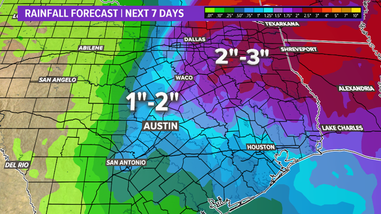
The heaviest rain is expected northeast of our area where the severe threat is highest. Central Texas will see less than an inch of rainfall for most locations.
With any system capable of producing strong storms, being prepared is the best practice to stay safe. Stay with the KVUE Storm team as details get fine-tuned for Friday.
Expect breezy, dry and cooler conditions behind the front for this weekend.
Be sure to download the KVUE app to get the latest weather news straight to your phone. You can download it in the App Store or Google Play. Also be sure to follow KVUE on Facebook, YouTube, Twitter and Instagram for updates on the weather.
PEOPLE ARE ALSO READING:
Pflugerville man says he found a tracking device under his truck after video caught someone under it
Unsealed affidavit reveals what may have happened to Heidi Broussard before her death