- Couple accused of creating videos of young girls using hidden cameras at The Woodlands Mall, Hurricane Harbor
- Couple accused of creating videos with hidden cameras at The Woodlands Mall, Hurricane Harbor
- The Texanist: Texas Gets More Tornadoes Than Any Other State, but Don’t Freak Out
- U.S. Supreme Court says Texans can sue state for flood damage
- This is how many hurricanes NC State researchers predict this year
Severe weather possible in parts of South Texas Wednesday morning
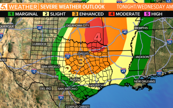
SAN ANTONIO — For tonight into Wednesday morning, strong to severe storms are expected to move through Texas with the higher chance for severe weather occurring in northeastern parts of the state.
South Texas’ risk for severe weather will be more into the Wednesday morning time frame with a marginal risk for severe weather, or a level one out of five.
While our chance for seeing severe storms is much lower than our friends in the northeastern part of the state, it is important to stay weather aware.
The main risk for the storms in South Texas will be damaging wind and large hail north of I-10 and for some areas east of I-37 down to the coastal bend.

Severe storms possible Wednesday morning
Meagan Massey
RELATED: WEATHER MINDS CLASSROOM: Severe Weather 101
All of these storms will be occurring ahead and along a cold front that will be moving though Tuesday night and into Wednesday.
The latest timing for the strong to severe storms shows them approaching the Austin area closer to 4 a.m. on Wednesday
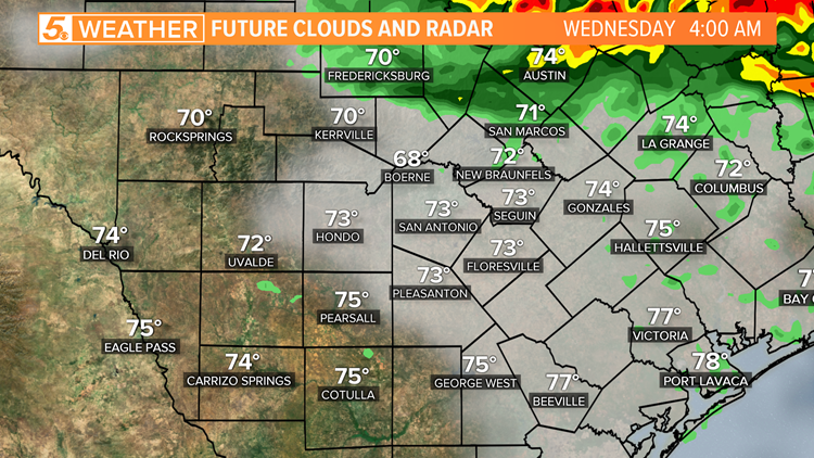
Strong storms possible Tuesday night into Wednesday morning.
Andrew Wilson
As we move through the morning, storms will continue to dip south, with the strongest of the storms likely staying east of the I-35 corridor by 6 a.m.
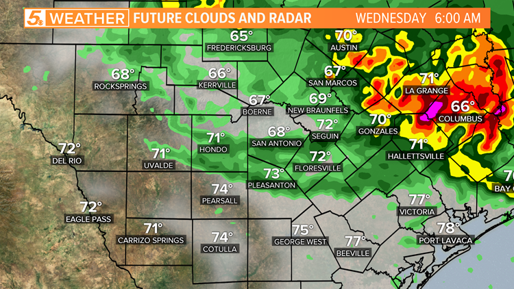
Strong storms possible Tuesday night into Wednesday morning.
Andrew Wilson
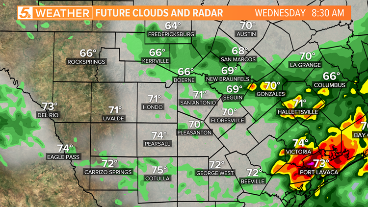
By 8:30 a.m., lingering storms will still be impacting parts of the I-10 corridor, but a majority of the stronger storms will have dipped south to the Victoria and Port Lavaca areas.
Strong storms possible Tuesday night into Wednesday morning.
Andrew Wilson
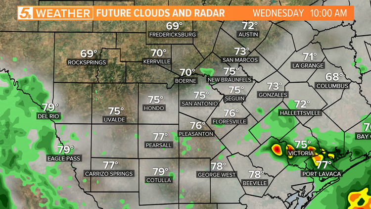
At 10 a.m., storms will start to move out of the region with just a few lingering around the coastal bend of Texas.
Strong storms possible Tuesday night into Wednesday morning.
Andrew Wilson
Quieter conditions will start to settle in behind the storms for Wednesday afternoon, but a few lingering showers will still be possible.
Much drier conditions move in for Thursday and into Friday.
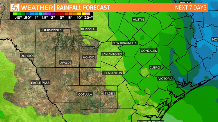
The amount of rain South Texas can expect to see over the next seven days will be less than half of an inch with a majority of the rain east of I-35.
Some spots west of I-35 will make it through the next seven days without seeing a drop of rain.
Strong storms possible Tuesday night into Wednesday morning.
Andrew Wilson
Don’t forget you can download the KENS 5 app for the latest news and weather information each day while you are on the go.
WATCH: A guided tour of the new KENS 5 app!
PEOPLE ARE ALSO READING:
SAPD: Woman kills her two kids, grandmother, before killing herself
12-year-old girl shot during violent home break-in, police say
Real-time updates: About 42 percent of all Bexar County coronavirus patients have recovered