- Man charged with sparking the most destructive wildfire in Los Angeles history
- Carolina Hurricanes start 2025-26 season hosting New Jersey Devils
- Speedy Sparks, bassist for Texas Tornados, other San Antonio music icons, has died
- Authorities make an arrest related to deadly January wildfire that leveled LA neighborhood
- AI simulation gives Carolina Hurricanes 20% chance to win 2026 Stanley Cup
Flash flooding, severe storms a threat for NC on Thursday, Friday

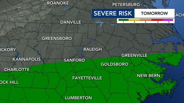
A flash flood watch is in effect for the Triangle and parts of North Carolina for Thursday and Friday, and counties south of Raleigh are under, a Level 2, or elevated, risk for severe weather.
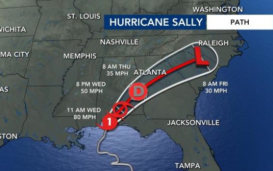
Tropical Storm Sally will cause a remnant low that will be south of North Carolina. Rain will be possible all day on Thursday and the first half of Friday.
The heaviest rain will be with us tomorrow late afternoon, evening and night.
As of 2 p.m. on Wednesday, Sally was moving north-northeast at about 5 mph with maximum sustained winds of 70 mph. It made landfall in Alabama at around 6 a.m. on Wednesday.
“We can’t rule out the possibility of a few isolated tornados at the center of circulation from Sally’s remnants near our southern counties,” said WRAL meteorologist Aimee Wilmoth.
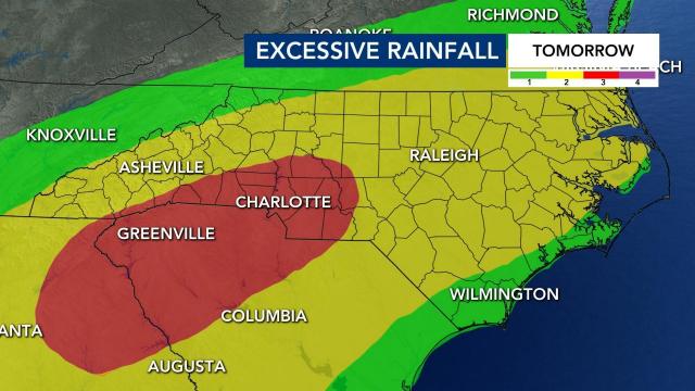
On Thursday, the Triangle is under a low to medium risk for excessive rainfall.
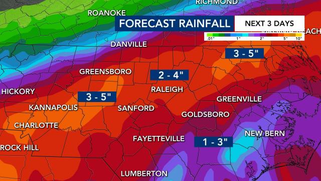
We are looking at getting 3 to 6 inches of rain over the next couple of days, according Gardner. Some pockets of the viewing area could get as much as 8 inches of rain from Sally.
North Carolina is going to see flooded roads and rivers will likely rise from heavy rain.
Thunderstorms should move out of our area by Friday night.
While Sally’s impact on the Gulf Coast could be severe, impacts in North Carolina will be minimal apart from the risk for flooding.
Since the weather is still nice outside for most of Wednesday, now is the time to start preparing for very heavy flooding.


