- Couple accused of creating videos of young girls using hidden cameras at The Woodlands Mall, Hurricane Harbor
- Couple accused of creating videos with hidden cameras at The Woodlands Mall, Hurricane Harbor
- The Texanist: Texas Gets More Tornadoes Than Any Other State, but Don’t Freak Out
- U.S. Supreme Court says Texans can sue state for flood damage
- This is how many hurricanes NC State researchers predict this year
Severe storms with potential for flash flooding expected in San Antonio this week
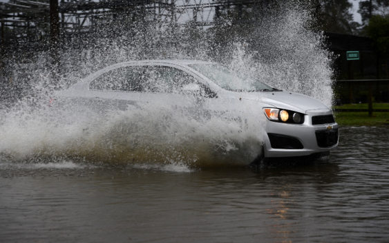
After bouts of rain over the weekend, the Alamo City can expect to see more storms this week.
San Antonio will face a marginal risk for severe thunderstorms Monday night, while there is an enhanced risk for storms across the Rio Grande and western part of the Hill Country, according to the latest update from the National Weather Service.
With the storms, South Central Texas can expect to see large hail, up to one inch in diameter, and damaging wind gusts, reaching near 60 mph, both of which have become more common over the last few weeks. West of San Antonio in Uvalde and Eagle Pass, however, hail could be more than two inches in diameter.
READ MORE: Andrea Meza of Mexico crowned 69th Miss Universe
While San Antonio has a lower risk for severe storms compared to areas such as Del Rio and Rocksprings, the heavy rainfall could also mean flash flooding in portions of the area through Wednesday. Along the Rio Grande Plains, there is a possibility of an isolated tornado.
Though the severity of the storms is expected to taper off after Wednesday, there is still a chance for rain Thursday through the weekend. San Antonio and the Hill Country can both expect to see between four and six inches of rain through Friday, while New Braunfels may receive between six and eight inches of rain.
Read more from Sarah