- AI simulation gives Carolina Hurricanes 20% chance to win 2026 Stanley Cup
- Warf steps down as president of Carolina Hurricanes
- Tornado in North Dakota was the first at EF5 strength in a dozen years
- Eric Tulsky comfortable, confident and going for the Stanley Cup in 2nd year as Hurricanes GM
- 5 homes collapse into the surf of the Outer Banks as hurricanes rumble in Atlantic
Flash Flooding Possible Today

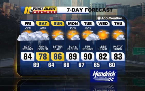
RALEIGH, N.C. (WTVD) — After yesterday’s heavy rain, more showers and storms are on the way and some of those storms will provide a flash flooding threat for this afternoon and evening. Expect a general 1-2″ of rain today with a few areas seeing anywhere from 3-4″ of rain. The main timing for most of these storms will be between 3pm and 9pm.
Rain will continue for tomorrow morning and early afternoon. It’ll be much cooler with highs only in the upper 70s in the Triangle, low 80s in the Sandhills.
Sunday will be the drier and brighter half of the weekend.
Monday and Tuesday will both be warm and humid with a few PM storms around before a cold front allows for cooler and more comfortable air come Wednesday.
Be Well & Stay Safe,
Robert Johnson
Copyright © 2021 WTVD-TV. All Rights Reserved.