- AI simulation gives Carolina Hurricanes 20% chance to win 2026 Stanley Cup
- Warf steps down as president of Carolina Hurricanes
- Tornado in North Dakota was the first at EF5 strength in a dozen years
- Eric Tulsky comfortable, confident and going for the Stanley Cup in 2nd year as Hurricanes GM
- 5 homes collapse into the surf of the Outer Banks as hurricanes rumble in Atlantic
Tropical Storm Fred could make landfall late tonight along Florida's panhandle

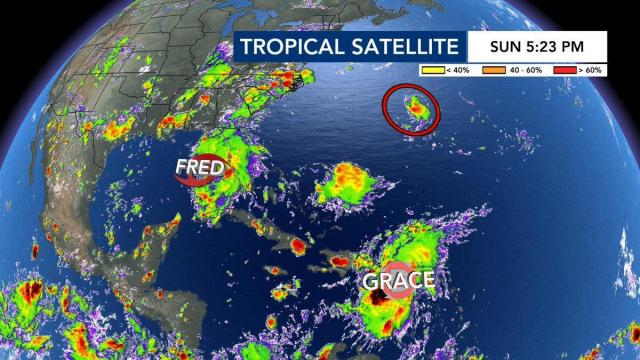
The tropics are active, and WRAL meteorologists are currently tracking three systems.
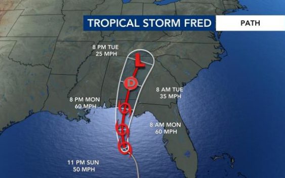
Tropical Storm Fred should make landfall late Monday night between 5 p.m. and 11 p.m. near Panama City, Fla., and is expected to bring heavy rain to western North Carolina midweek.
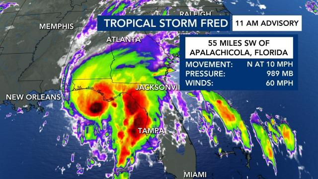
“Fred definitely looking a bit more organized now with winds at 60 miles per hour as it approaches land,” said WRAL meteorologist Elizabeth Gardner.
As of noon on Monday, Fred was 55 miles southwest of Apalachicola, Fla.
According to Gardner, Fred is expected to bring heavy rain to parts of Florida and Alabama Monday before it dissipates. Remnants from the storm will bring rain to North Carolina Tuesday and Wednesday, but the strongest impact will be in the mountains.
The western part of our state could see 6 to 10 inches of rain due to an upslope wind. Fred will force winds to move upwards, condense and allow more rain to fall.
Tropical Depression Grace is expected to become a tropical storm later this week, Gardner said, and will likely make landfall in Mexico. Grace will impact Haiti on Monday, bringing flooding and mudslides to the country still trying to recover from a devastating earthquake.
Grace is not expected to impact the United States.
Tropical Depression 8, near Bermuda, formed late Sunday night and is not yet a threat to land, although it could increase North Carolina’s rip current risk later this week. If named, the storm would be “Henri.”
According to the NOAA 2021 Hurricane Forecast, we can expect 13-20 named storms, 6-10 hurricanes and 3-5 major hurricanes.


