- Disaster declaration issued by San Antonio-area leaders after historic floods that killed 13
- Officials issue disaster declaration after deadly June 12 flooding in San Antonio
- Florence Co. investigators travel to Brunswick County for human remains, missing person case
- North Carolina lawmakers clash over next round of Hurricane Helene funding
- City of San Antonio launching investigation into cause of last week's deadly flooding
Tropical Storm Grace passes over Yucatan Peninsula: Track the storm, possible impacts

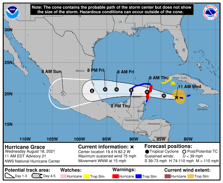
Grace was downgraded to a tropical storm Thursday morning as it passes over the Yucatan Peninsula, but it is expected to intensify later this weekend.
Grace has maximum sustained winds of 65 mph, making it a Category 1 storm, according to an advisory issued at 10 a.m. from the National Hurricane Center.
The storm is has weakened as it passes over the Yucatan Peninsula, but it is expected to strengthen again when it moves into the southwestern Gulf of Mexico. Grace is forecast to make landfall as a hurricane late Friday in Mexico.
Tropical-storm-force winds extend outward up to 140 miles from the center.
Grace is located 110 miles east of Campeche, Mexico, and is moving west at 18 mph. It is forecast to continue a west to northwest movement through Friday, where it will turn slightly to a west-southwestward motion.
Cone of uncertainty: See the latest graphic from the NHC
Satellite images: See latest satellite image from NOAA, for a clearer picture of the storm’s size

Latest data on Grace
Here is the latest data on Tropical Storm Grace pulled from the National Hurricane Center’s 10 a.m. advisory.
- Location: 110 miles east of Campeche, Mexico
- Maximum sustained winds: 65 mph
- Movement: west at 18 mph
- Pressure: 994 MB (millibars)
- When next advisory will be released: 1 p.m. CT