- Crews making progress to contain wildfire in rural area west of Fredericksburg
- Crews battle wildfire in rural area west of Fredericksburg
- Capitol Conspiracies: Texas Republicans are flooding the session with bills based on online hoaxes
- Wildfire raging in rural area west of Fredericksburg
- Tornado trio: Three tornadoes strike same county 11 hours, 14 miles apart
Temperatures soar again, Level 2 risk for severe weather tomorrow

Raleigh, N.C. — A line of strong storms impacting the Deep South is approaching North Carolina.
The storms left widespread damage in Texas on Monday and drifted into Louisiana, Mississippi and Alabama on Tuesday. WRAL meteorologist Elizabeth Gardner said the threat will be lessened by the time the storms reach our area.
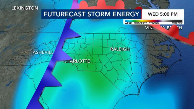
The state is under a Level 2 risk for severe weather beginning Wednesday night, when storms are expected to arrive in central N.C. There is a low risk for tornadoes and hail, but isolated flooding and wind damage will be likely, and up to 1 inch of rain could fall.
“It’s beginning to look like an overnight Wednesday, early Thursday morning event for us,” Gardner said.
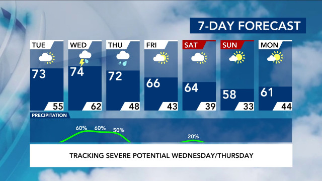
Before the storms, Tuesday will be a dry, cloudy day, with a high in the low to mid 70s. Wednesday, which will be a mostly dry day, will be even warmer before the storms move in overnight.
The severity of the storms largely depends on when they move into the area, Gardner explained. If the storms move in earlier in the evening, when the heat from the day is still present, there will be more energy for the storms. Wednesday’s storms are expected to arrive overnight, when it is cooler, so there will be less energy and a lessened risk.
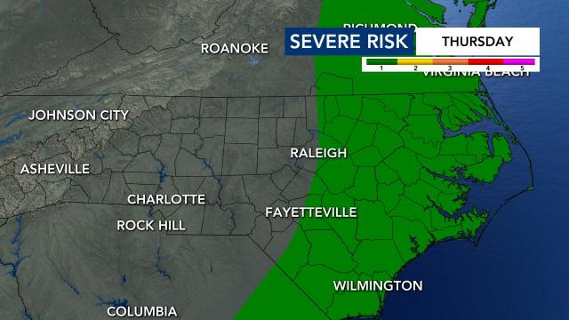
The storms should move away Thursday morning, but a Level 1 low risk goes into effect for eastern North Carolina, where wind damage is possible. There could be some lingering rain throughout the afternoon, but the storm risk is largely overnight.
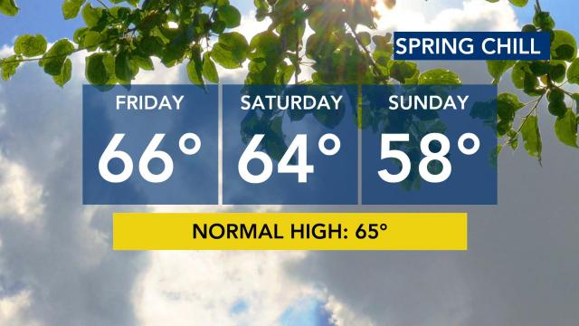
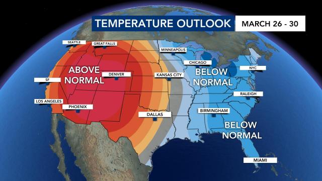
Temperatures will be cooler, in the 60s, for Friday and Saturday. On Sunday, highs will be in the upper 50s. The weekend should be clear, and we could be close to freezing Monday morning, when lows drop into the lower 30s.
Eager to get the garden going?
Wondering if it’s okay to start planting? Temperatures will stay spring-like for a while, but cooler temperatures are ahead. We’re expecting cooler than average temperatures next week, according to meteorologists.
Our average last freeze comes in mid-April.
