- Hutto ISD announces early dismissal Friday due to severe weather risk
- Hutto ISD schools dismissing early Friday due to possible severe weather
- Crews responding to wildfire in Boiling Spring Lakes
- Live radar: Strong storms end Thursday evening; more severe weather expected on Friday
- At least 1 tornado touches down in Burnet County as storms pound Central Texas
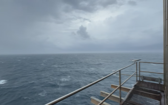
A look from Frying Pan Tower as Tropical Storm Debby approaches

FRYING PAN SHOALS (WWAY) — As the Cape Fear prepares for Tropical Storm Debby, one man offshore is battening down the hatches, literally.
Richard Neal, who WWAY interviewed during our Voyage to Frying Pan Tower series is staying in the tower this week as the storm passes overhead.
Neal has stayed in the tower for several storms over the years. The tower lies more than 30 miles off the North Carolina coast, and usually sees much stronger winds and rain than we do back on land.
Neal said even as the first few bands of Debby make their way north, conditions are already looking rough.
“We are seeing some pretty constant 20-40 mph winds and that’s going to make the waves build. I’m looking out the window right now, and they’re probably six or eight feet tall, white caps on everything,” he said. “We don’t feel any shaking or vibration, but I guarantee you, unless you’re an expert surfer, you don’t want to be in that stuff. It’s going to be a mess over the next 24 hours at least.”
In case you’re wondering, Neal does have power and internet, making our interview with him possible.