- Eric Tulsky comfortable, confident and going for the Stanley Cup in 2nd year as Hurricanes GM
- 5 homes collapse into the surf of the Outer Banks as hurricanes rumble in Atlantic
- As hurricanes pass offshore, more Buxton homes collapse into the sea
- Central Texas floods reveal need to shore up disaster response in unincorporated areas
- Latest: Tropical Storm Imelda will pull away from East Coast, expected to become a hurricane
Ask the Meteorologist: What's the most concerning part of hurricanes in North Carolina?
We are now less than a month away from the official start to hurricane season. Hurricane season in the Atlantic runs from June 1 to November 30.
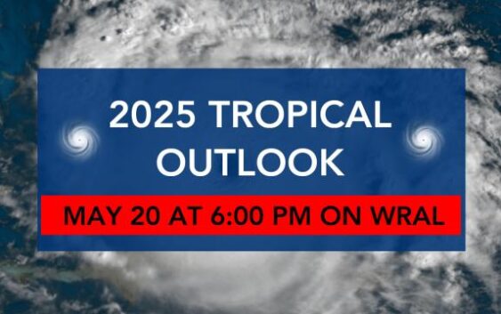
The WRAL Severe Weather Team will air its 2025 Tropical Outlook Tuesday, May 20, at 6 p.m.
In our part of the state, we have a lot of people moving from different areas – areas that maybe aren’t used to tropical weather (ie. California, Illinois, Pennsylvania, New York, etc.). That’s the main driver behind putting this story together in the first place.
A variety of threats
Hurricanes are a big deal in North Carolina. I mean – our NHL team is quite literally named after them.
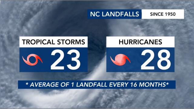
Since 1950, more than 50 storms have made landfall on the North Carolina coast.
Landfall, however, doesn’t tell the whole story. You have several storms that move through the state that never make landfall on our coast (ie. Debby and Helene in 2024).
Depending on the storm track and your location, you can get anything from storm surge to flooding and extreme winds to tornadoes.
In 2024 alone, our viewing area saw two EF-3 tornadoes. One was in Lucama during Debby, and the other was in Rocky Mount during Helene.
Flooding in recent storms
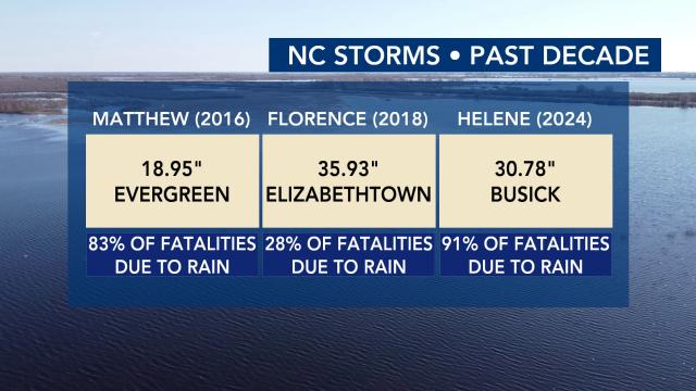
Within the last decade, you can look back toward several storms that flooded parts of the state with extremely high rain totals.
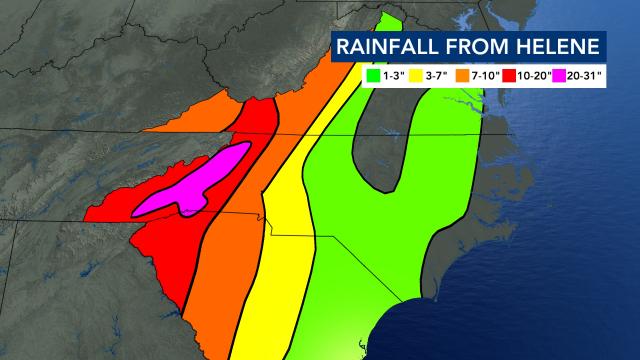
Obviously, recency points us toward Helene and its devastating impact on the western part of the state. It was an odd circumstance in which the eastern part of the state was relatively unphased compared to the mountains.
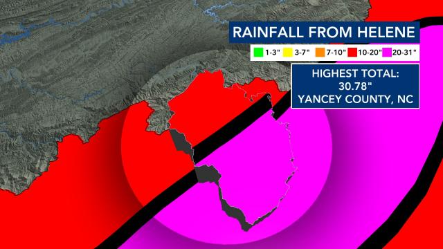
The highest rain total exceeded 30 inches in Yancey County, North Carolina.
Between the unrelenting rain, the punishing wind, the terrain and the fact that the western half of the state isn’t as accustomed to storms of this magnitude, Helene etched itself into the wrong side of history in North Carolina.
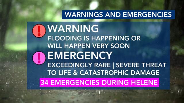
It was a storm that, between North Carolina, South Carolina, Tennessee, Virginia and Kentucky, prompted 34 flash flood emergencies.
These will be issued in rare, life-threatening situations during floods.
Storms such as Matthew in 2016 and Florence in 2018 prompted more of the same alerts to be issued in North Carolina.
Florence holds the rainfall record due to a tropical system in the state.
Does the Category even matter?
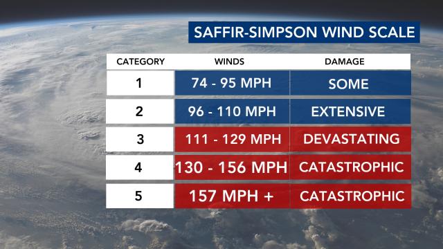
It brings up the argument that the Saffir-Simpson scale (the way hurricanes are rated on Category) should be re-worked.
This scale is solely based on the observed/estimated wind speed surrounding the eye of a tropical system.
It doesn’t take into account flooding, storm surge and/or tornado threats associated with the storm.
I remember during Florence, people along the coast would post things like, “I evacuated for a Category 1?!”
You evacuated for a storm that brought historic rain – nearly three feet in some places. And that was probably a good move! That category, however, didn’t reflect the devastating flow that would be dealt by the rain.
Helene was a tropical storm by the time it moved through North Carolina. Could you imagine us saying something like, “it’s just a tropical storm,” or “it’s been downgraded.”
How should we treat tropical threats?
My advice when it comes to tropical systems is this:
Impacts > Category
- Hurricane season can be exhausting. It runs for six months. Updates are frequent. Misinformation is rampant.
- Also keep in mind that no two storms are exactly alike. Your experience during Hugo or Floyd, Matthew or Florence , Debby or Helene probably differed from storm to storm.
Our job is to lay out realistic expectations depending on the storm’s path and strength.
Have questions about the weather and how it works?
Send me an email with the subject line ‘Ask the Meteorologist:’ to cmichaels@wral.com.
