- Florence to begin interviewing police chief finalists in January
- A West Texas county wants to better prepare for floods. Paying for it will be tricky.
- They couldn’t save their daughters’ lives in the July 4 floods. Now they’re dealing with the grief and the guilt.
- Austin could see heavy rains, possible flooding over the next few days
- Families of campers, counselors who died in Texas Hill County floods sue Camp Mystic
Gov. Stein provides updates on Hurricane Erin

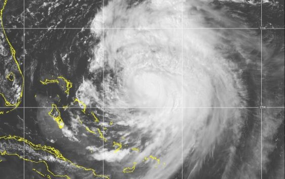
RALEIGH, NC (WWAY) — Governor Josh Stein and state officials are urging coastal residents and visitors to stay alert as Hurricane Erin continues to impact North Carolina with dangerous surf, flooding, and rip currents.
At a Wednesday briefing, Stein was joined by Director of Emergency Management Will Ray, N.C. Department of Public Safety Secretary Eddie Buffaloe, N.C. Department of Transportation Secretary Joey Hopkins, Adjutant General of the North Carolina National Guard Major General Todd Hunt, and State Highway Patrol Commander Colonel Freddy Johnson.
“While Hurricane Erin is expected to remain offshore, North Carolinians along the coast must remain vigilant as coastal flooding and life-threatening rip currents continue to impact the region,” Stein said. “Our State Emergency Response Team remains ready to quickly respond to any needs and keep coastal residents and visitors safe.”
Ray reminded residents that if evacuation orders are in place, they should be followed before conditions worsen.
“Do not drive around barricades and do not drive through flooded waters,” Ray said. “You cannot judge the depth or speed of flood waters from inside your vehicle. Please remain informed and have a plan to protect yourself today, tonight, and tomorrow if you are along our coast.”
State of emergency and preparations
On Tuesday, Stein declared a state of emergency to mobilize resources ahead of the storm. State officials said swift water rescue teams and National Guard troops, along with boats, high-clearance vehicles, and aircraft, have been prepositioned. Two CH-47 helicopters from neighboring states are on standby to deliver food and water if needed.
A state-operated disaster shelter has opened at 113 Wilcox Street in Warrenton, hosted by Warren County Emergency Management. Pets are allowed at the shelter.
Forecast and coastal impacts
Forecasters expect Erin to cause extensive beach erosion with waves of 15 to 20 feet, coastal flooding that may impact roads and structures, and dangerous rip currents throughout the week. Tropical storm-force winds are likely to reach the coast, especially the Outer Banks, late Wednesday into Thursday.
NCDOT crews have reinforced vulnerable sections of NC 12 with bulldozers and front-end loaders to protect against flooding and overwash. Ferry service between Ocracoke and Hatteras is continuing as long as conditions allow. Officials say more than 2,200 people and 1,100 vehicles have already evacuated Ocracoke Island since Hyde County issued a mandatory evacuation order on Sunday.
“We have crews ready and are prepared for whatever Erin brings us,” Hopkins said. “But we are urging people along the coast to stay home until the storm passes and it’s safe to travel again.”
Safety reminders
Officials shared these tips to help North Carolinians stay safe:
Be informed: Follow the National Weather Service, local media, and local emergency management updates.
Have a disaster kit: Include documents, cash, prescriptions, chargers, and insurance policies.
Have a plan: Know your evacuation route. Visit KnowYourZone.NC.gov
Turn around, don’t drown: Never drive into flooded roadways.