- Ask the Meteorologist: Did a tornado hit Johnston County Saturday night?
- Demolition begins on flood-damaged homes in Stoney Creek as neighbors await relief
- NC Office of State Fire Marshal aiding in Hurricane Melissa relief efforts
- U.S.-based aid groups rush to get supplies into storm-battered Jamaica after Hurricane Melissa
- Travelers stuck in Jamaica due to Hurricane Mellissa forced to pay for unwanted extended stay
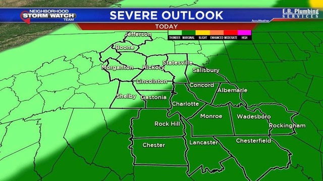
Counties under risk of damaging winds, storms

 FOX 46 Charlotte
 (FOX 46 WJZY) – Tuesday morning will start with mist and fog. The fog will eventually lift but the rain will increase in intensity as a cold front moves in through the midday hours.
The biggest concerns will be straight line wind damage between the hours of 11 a.m. and 4 p.m. Skies will clear later Tuesday evening and the rest of the forecast period looks quiet until Friday.
Today: Showers and storms with strong storms around lunch time. 60% chance for rain. Wind gusts of 40-50 mph possible. High of 74.
Tomorrow: Partly sunny with a 20% chance for showers. High of 71.
Thursday: Partly sunny and 64.
Another round of showers move in on Friday with a 60 percent chance for rain. This weekend looks great with sunny skies and highs in the 50s.
Related: NC counties under risk of damaging winds, isolated tornado on Tuesday
Chances for severe weather are possible today. Mainly the risk of straight line wind damage especially in areas shaded in dark green. Worst weather will cross through the area between 11a – 4 p. @FOX46News pic.twitter.com/lev4B5gg4T
— Nick Kosir (@FOX46Nick) November 6, 2018