- They couldn’t save their daughters’ lives in the July 4 floods. Now they’re dealing with the grief and the guilt.
- Austin could see heavy rains, possible flooding over the next few days
- Families of campers, counselors who died in Texas Hill County floods sue Camp Mystic
- Small plane bound for Jamaica with hurricane relief supplies crashes in Florida neighborhood
- Ask the Meteorologist: Did a tornado hit Johnston County Saturday night?
Waze app being updated with road closures, evacuation routes during this week's severe weather threat
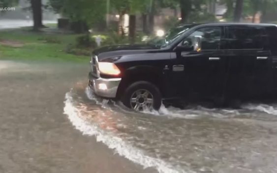
HOUSTON — Tuesday’s severe weather was the first of many rounds expected over the next few days.
With street flooding being the biggest threat, a navigation app wants to make sure that Houstonians are safe on the roads.
RELATED: Tornado Warnings and Watches issued for areas north of Houston
RELATED: Weather Timeline: Flood risk continues with more rain and storms expected
RELATED: Flash flooding strands drivers in Sugar Land and Kingwood
Waze says their app is being updated in real-time with road closures and evacuation routes. The app will also let you know how many shelters are open in your area and their locations.
Wazers will also be able to take advantage of the new Roadside Help features and make emergency calls to police, ambulances and the fire department without leaving the app.