- New legislative panels will investigate ‘facts and circumstances’ of deadly Central Texas floods
- Heavy rain floods downtown Whiteville forcing local businesses to deal with damage again
- New legislative panels will investigate “facts and circumstances” of deadly Central Texas floods
- Springfield Middle School fully reopens next week, a year after devastating EF3 tornado
- Dozens rescued as remnants of typhoon hits Alaska while nor’easter brings flooding to East Coast
New Orleans hit with street flooding ahead of tropical weather

The low pressure area was over water, south of the Florida Panhandle early Wednesday and was expected to strengthen into a storm as it moved west through the Gulf’s warm waters.
Forecasters say parts of Louisiana could see up to 12 inches of rain by Monday, with heavier amounts possible in some spots.
Mississippi and Texas were also at risk of torrential rains.
The National Weather Service said New Orleans is protected to a river level of 20 feet, but it was forecast to rise above flood stage to 19 feet by Friday.
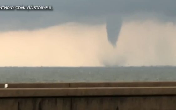
Though much of the heaviest rain isn’t expected until the weekend, the broad area of disturbed weather in the Gulf was already producing strong thunderstorms over Louisiana on Wednesday. Those storms prompted tornado and flash flood warnings Wednesday morning in the New Orleans area. The weather service said up to 3 inches (7.6 centimeters) of rain had fallen in the area.
RELATED: Hurricane predicted to make landfall this weekend | Houston is in the cone
Copyright © 2019 by The Associated Press. All Rights Reserved.