- Tropical Storm Melissa nears hurricane strength and dumps torrential rain on Caribbean
- Tropical Storm Melissa lumbers through the Caribbean as islands take cover from rain
- Tropical Storm Melissa brings flood risk to Haiti, Dominican Republic and Jamaica
- Army Corps evaluates Wrightsville Beach storm damage; could accelerate re-nourishment plans
- Austin and Travis County issue disaster declaration as wildfire risk rises
Raleigh, Durham under level 2 risk for severe weather
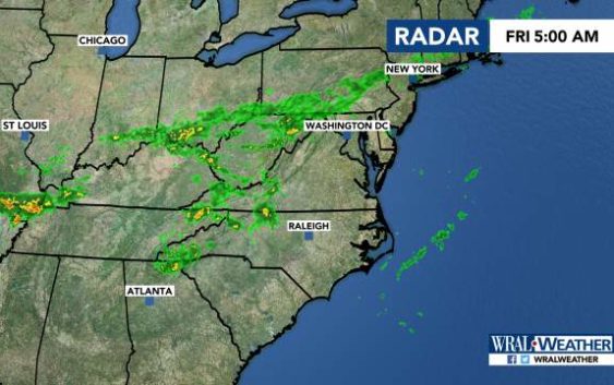
Raleigh, N.C. — The Triangle and northeastern parts of North Carolina are under a level 2 risk for severe weather on Friday.
Most other parts of the state are under a level 1 risk.
Strong thunderstorms could hit any part of central North Carolina, meteorologist Elizabeth Gardner said, but storms are most likely in Raleigh, Durham, Rocky Mount and northward and eastward into Virginia.
Damaging winds and heavy rain are likely. Also possible are microbursts, which are often straight-line winds that can knock trees down. While microbursts don’t have the rotation of a tornado, they can create just as much damage on the ground.
Download the WRAL Weather App to get severe weather alerts.
The storms come after a disturbance brought 60-mph gusts, quarter-inch hail and frequent lightning to the area Thursday.
Friday morning will be mostly clear, with a shower possible in Durham.
The chance for storms increases as the afternoon goes on, with a 40% chance for rain at 4 p.m. and an 80% chance at 5 p.m.
Temperatures will peak in the upper 80s.
High temperatures will dip down to 76 degrees on Saturday. Rain is possible, but thunderstorms aren’t likely.
