- U.S.-based aid groups rush to get supplies into storm-battered Jamaica after Hurricane Melissa
- Travelers stuck in Jamaica due to Hurricane Mellissa forced to pay for unwanted extended stay
- Raleigh police officer awaits word from family in Jamaica after Hurricane Melissa devastation
- North Carolina’s leaders give insight on the effects of Hurricane Melissa
- ‘We want some answers;’ Whiteville residents demand city response to prevent flooding
Tropical Storm Jerry forms in the Atlantic, too early to know if it will impact US

Tropical Storm Jerry formed in the Atlantic early Wednesday morning, but it’s too early to tell if it will impact North Carolina.
Jerry is the 10th named storm of the Atlantic hurricane season. According to WRAL meteorologist Elizabeth Gardner, Jerry is far from land but is gaining intensity and forward speed on a path to approach the Leeward Islands as a hurricane on Thursday night or Friday.
According to Gardner, Jerry is likely to interact with a system that will start to turn it toward the north, “but it’s not turning it north as quickly as we would like.” Most scatter plots turn Jerry to the north, keeping it away from the United States, but the storm is not guaranteed to stay in the Atlantic.
We’re currently in the peak of hurricane season, and there are two other storms meteorologists are keeping their eyes on, Gardner said.
The U.S. National Hurricane Center says Imelda is now a tropical depression, dumping 6 to 10 inches of rain on Houston.
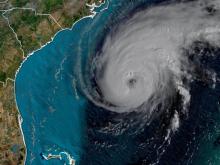
Hurricane Humberto, now a Category 3 storm, has increased its forward speed moves closer to Bermuda.
Forecasters say hurricane conditions are expected to reach the island Wednesday night and continue into early Thursday morning with rainfall accumulations of 2 to 4 inches with maximum amounts of 6 inches expected.
“Fortunately, Bermuda won’t see the worst of the storm,” Gardner said. “It will kind of slip by.”
The center says Humberto is a large storm with hurricane-force winds extending 60 miles from the center. It is expected to remain powerful through Thursday.
