- Families of campers, counselors who died in Texas Hill County floods sue Camp Mystic
- Small plane bound for Jamaica with hurricane relief supplies crashes in Florida neighborhood
- Ask the Meteorologist: Did a tornado hit Johnston County Saturday night?
- Demolition begins on flood-damaged homes in Stoney Creek as neighbors await relief
- NC Office of State Fire Marshal aiding in Hurricane Melissa relief efforts
Risk for severe weather in the Cape Fear tonight
Share on Facebook
Tweet on Twitter
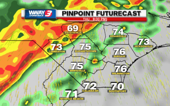
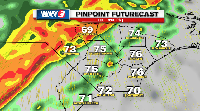
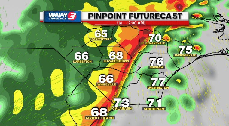
WILMINGTON, NC (WWAY) — The Cape Fear region is under a Category 3 risk for severe weather Thursday.
The National Weather Service expanded its “enhanced” area to include the entire Cape Fear Region. Bladen, Columbus, Pender, New Hanover, and Brunswick are now all under an enhanced risk for severe weather Thursday.
A cold front will bring a threat for severe weather on Feb. 6, 2020. (Photo: WWAY)

A cold front will bring a threat for severe weather on Feb. 6, 2020. (Photo: WWAY)
– Advertisement –
Passing showers and storms are possible during the day, otherwise very warm and breezy conditions.
In addition to the wind threat, areas west of Interstate 95 are under a Flood Watch through late Thursday night.
Heavy rain and damaging winds are the primary threats with Thursday night’s storms. There is also a small chance for isolated tornadoes.
The storms will last from the evening into early Friday.
After the storms, temperatures will cool down and stay mainly dry for the weekend ahead.
Get your latest forecast here.
Download the WWAY News and StormTrack 3 Weather apps on your smart phone or tablet device to receive breaking news and weather push notifications the minute it happens.