- Ask the Meteorologist: Did a tornado hit Johnston County Saturday night?
- Demolition begins on flood-damaged homes in Stoney Creek as neighbors await relief
- NC Office of State Fire Marshal aiding in Hurricane Melissa relief efforts
- U.S.-based aid groups rush to get supplies into storm-battered Jamaica after Hurricane Melissa
- Travelers stuck in Jamaica due to Hurricane Mellissa forced to pay for unwanted extended stay
Tropical Depression 13 has become Tropical Storm Laura on its slow journey toward the Gulf
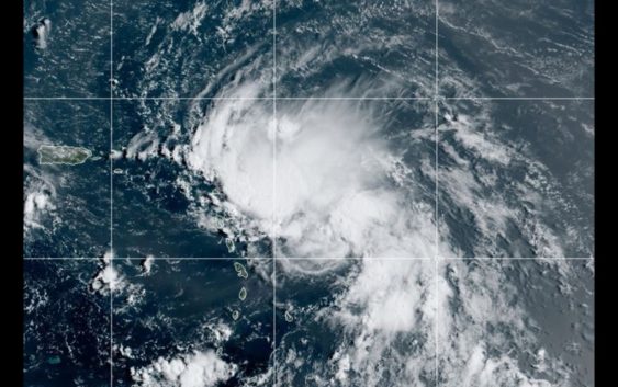
HOUSTON — Tropical Storm Laura has formed in the Atlantic with 45 mph maximum sustained winds.
What had been Tropical Depression 13 is currently 230 miles east-southeast of the Northern Leeward Islands near the Caribbean.
The Hurricane Hunter found its center is further south than previously expected.
Laura, is one of three tropical waves coming out of the Atlantic that have a high chance of development in the next five days. It’s far too soon to know where these will go, but we are watching Tropical Depression Fourteen especially closely. It is expected to enter the Gulf early next week. Get the latest detailed tropics update here.
Meanwhile, our weather is expected to be fairly quiet through the coming weekend. Look for mostly sunny skies the rest of the day Thursday, Friday and into the weekend. Temperatures should hover in those upper 90s.
Small chances of rain will be introduced on Sunday and Monday ahead of what could potentially be a tropical storm or hurricane moving towards the Texas or Louisiana coasts on Tuesday morning.
Houston 7-day forecast
Tropics update
Live Houston-area radar