- Families of campers, counselors who died in Texas Hill County floods sue Camp Mystic
- Small plane bound for Jamaica with hurricane relief supplies crashes in Florida neighborhood
- Ask the Meteorologist: Did a tornado hit Johnston County Saturday night?
- Demolition begins on flood-damaged homes in Stoney Creek as neighbors await relief
- NC Office of State Fire Marshal aiding in Hurricane Melissa relief efforts
Central North Carolina under Level 1 for severe weather; strong storms with damaging winds possible later Saturday
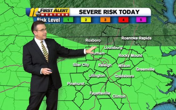
On Saturday, central North Carolina has a Level 1 chance for severe weather, meaning strong to severe storms could happen later today.
First Alert Meteorologist Steve Stewart said a frontal boundary will move through the Carolinas Saturday afternoon, producing spotty showers and isolated thunderstorms.
Watch for storms later today…some could be strong to severe. We are in a level 1 out of 5 risk for severe weather with the main risk damaging straight line winds. pic.twitter.com/MagAec2P6T
— Steve Stewart (@StewartABC11) March 27, 2021
What are straight-line winds and how do they form
As a potent low pressure system passes through the Northeast Sunday, a cold front tied to the system will sweep across the Southeast and Mid-Atlantic Sunday night into Monday. This is expected to bring another round of rain and gusty thunderstorms. Around the Triangle, damaging winds will be a possible threat.
Copyright © 2021 WTVD-TV. All Rights Reserved.