- AI simulation gives Carolina Hurricanes 20% chance to win 2026 Stanley Cup
- Warf steps down as president of Carolina Hurricanes
- Tornado in North Dakota was the first at EF5 strength in a dozen years
- Eric Tulsky comfortable, confident and going for the Stanley Cup in 2nd year as Hurricanes GM
- 5 homes collapse into the surf of the Outer Banks as hurricanes rumble in Atlantic
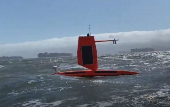
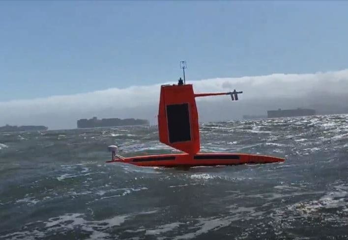
World’s first ocean drones to track real-time data in middle of hurricanes
SOUTHEASTERN NC (WCTI) — It’s now officially the start of hurricane season, and scientists are hard at work trying to keep us safe. With the help of game-changing new drones, they’ll be able to venture into depths they’ve never gone before, right into the eye of the hurricanes.
The National Oceanic and Atmosphere Administration, known as ‘NOAA,’ is partnering with a company called Saildrone to launch 5 ocean drones along the eastern North Carolina coast. The five little orange warriors, known as ‘saildrones,’ will set off to sea this summer. Their mission is to gather data from the heart of the hurricanes that will hopefully save lives.
“That data is very important,” said Andy Ziegwied, Vice President of Ocean Data for Saildrone, “It’s never been collected before from the sea surface, so it’s quite novel.”
It’s complex data that measures the exchange of energy between a hurricane and the ocean, which NOAA oceanographer and leader on the mission Greg Foltz says is incredibly difficult to get.
“Very rare to have. So if we can get those measurements, that’ll be like a research objective and if we can understand this energy and this momentum exchange better, that can go into the models, help make the models better,” explained Foltz.
The drones will monitor heat, wind speeds, water pressure, and other metrics and communicate them to scientists as the storm is happening.