- Carolina Beach is warning of potential King Tide flooding
- NCDEQ launches Hurricane Helene recovery grants program
- Why no hurricanes made landfall in the US in 2025
- Florence to begin interviewing police chief finalists in January
- A West Texas county wants to better prepare for floods. Paying for it will be tricky.
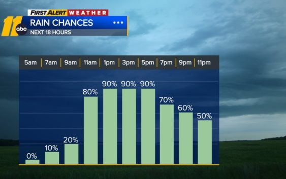
Severe storms may bring heavy rain, damaging winds and possible tornadoes

Wednesday, January 25, 2023 11:02AM

RALEIGH, N.C. (WTVD) — Severe thunderstorms with heavy downpours, damaging wind gusts and even an isolated tornado will be possible today, especially east of the Triangle. Strong wind gusts to 45 mph will also be possible.
The system brings initial spotty showers between 7-10 a.m. before the main push of rain and thunderstorms arrives in the area later this morning, perhaps even after noon to the east.
The risk of severe weather will increase into the mid-afternoon hours and through early evening.
We should expect 0.50-1.00″ of rain for much of the area, but higher amounts will be possible in stronger storms.
After the system moves through the area, we’re looking at calmer conditions.
Copyright © 2023 WTVD-TV. All Rights Reserved.
Related Topics