- Carolina Beach is warning of potential King Tide flooding
- NCDEQ launches Hurricane Helene recovery grants program
- Why no hurricanes made landfall in the US in 2025
- Florence to begin interviewing police chief finalists in January
- A West Texas county wants to better prepare for floods. Paying for it will be tricky.
Saturday Thunderstorm in Mecklenburg County results in threat of flooding, damaging wind and power outages
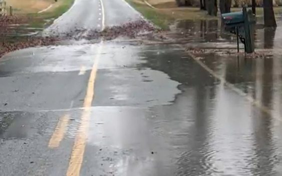
CHARLOTTE, N.C. — A severe thunderstorm over Charlotte Saturday caused a threat of damaging wind and localized flooding.
The storm, which formed quickly around the 1 p.m. hour, prompted the National Weather Service to issue both a severe thunderstorm warning and a flash flood warning.
Radar estimates show the show was capable of winds around 60 mph and quarter-size hail. The same radar estimates showed the storm produced nearly two inches of rain in an hour.
As a result of the heavy rainfall, several Mecklenburg County creeks quickly rose. A creek gauge along Briar Creek near Providence Road shows the water level rose at least 7 feet in an hour. Another gauge along the Little Sugar Creek near Atrium Health’s Carolina Medical Center hospital rose nearly 8 feet.
Drivers are encouraged to not drive through flooded roadways.
Duke Energy reported roughly 5,000 customers without power shortly before 2 p.m.