- Carolina Beach is warning of potential King Tide flooding
- NCDEQ launches Hurricane Helene recovery grants program
- Why no hurricanes made landfall in the US in 2025
- Florence to begin interviewing police chief finalists in January
- A West Texas county wants to better prepare for floods. Paying for it will be tricky.
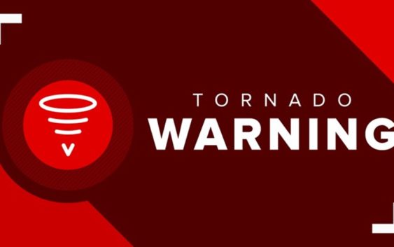
Tornado warnings issued for Iredell, Rowan counties until 5:30 p.m.
There is a high risk of high winds, hail, lightning and heavy rainfall through Monday evening.
CHARLOTTE, N.C. — Tornado and severe thunderstorm watches have been issued for several North Carolina counties because of a severe weather threat through Monday evening.
The National Weather Service upgraded the severe thunderstorm warning to the “destructive” tier shortly before 5 p.m. It’s the highest tier for a damaging severe storm.
The watch, which means conditions are favorable for the development of both tornadoes and severe thunderstorms, is in effect for Avery, Catawba, Caldwell, Alexander, Burke, Rowan, and Iredell counties.
A severe thunderstorm watch is in effect for the rest of the Charlotte area, including Cabarrus, Chester Cleveland, Gaston, Lincoln, Mecklenburg, York and Union counties. Everyone throughout the Carolinas should remain Weather Aware of the threat of damaging, severe weather on Monday.
The Charlotte area will see an extremely rare significant risk of severe weather with the possibility of severe winds and isolated tornadoes across the Carolinas Monday afternoon, chief meteorologist Brad Panovich said.
The possibility of severe weather and the risk of damaging winds across the entire Charlotte region is why Panovich and the entire WCNC Charlotte team of meteorologists say people should be Weather Aware Monday.
While a severe weather watch may extend for hours, individual storm warnings will be issued on a more localized level as individual storms pose threats in real-time and in the minutes ahead.
For the latest weather alerts, download the WCNC Charlotte mobile app and enable push notifications.
The biggest risk will be damaging winds, but there is a chance of isolated, spin-up tornadoes, as well as excessive lightning, hail and heavy rain. Panovich says Monday’s risk of severe winds is as high as he’s ever seen in the Carolinas.
“Winds are almost into the extreme category,” Panovich said. “There’s a 45% chance of within 25 miles of any point on the map of seeing severe winds. That’s 58 or 60 mph or higher. That’s a 50-50 shot you’re going to see wind damage within 25 miles of your location.”
The line first moved into the North Carolina mountains around 3 p.m. and is expected to get to the Charlotte metro around 5 p.m. Meteorologist Chris Mulcahy says it’s rare for this type of setup to hit so late in summer, as the storms could form a “bow echo,” which can lead to spin-up tornadoes that happen within the leading edge of storms.
Forecaster Larry Sprinkle said the entire Charlotte area will be at risk for severe storms, which is why everyone should be Weather Aware.
“Every single county in our area is covered in the severe weather outlook,” Sprinkle said. “If you’re watching us, you’re in the bullseye for the potential for these strong storms tracking across the Charlotte area.”
In the bullseye
A stretch of more than 800 miles is at high risk of damaging winds and severe weather Monday. That means one in three storms has the potential for creating severe weather. The Charlotte area hasn’t seen this kind of setup all year long, according to Mulcahy.
“How often is it that we’re in the bullseye? Literally, we’re right in the center of this,” Mulcahy said.
Areas at high risk of severe thunderstorms and damaging winds include Albemarle, Boone, Charlotte, Chester, Concord, Gastonia, Hickory, Huntersville, Lancaster, Lincolnton, Monroe, Mooresville, Morganton, Rock Hill, Salisbury, Statesville, Taylorsville and Waxhaw. Simply put, if you’re in the Charlotte area, you need to be Weather Aware.
Storm timing
Monday has been very hot and humid across the Carolinas. With forecast temperatures in the mid-to-upper 90s and heat index values at or above 100 degrees, there’s plenty of “thunderstorm fuel” to generate severe weather. A heat advisory had been in effect for Anson, Cabarrus, Chester, Lancaster, Mecklenburg, Stanly and Union counties in the Charlotte area.
The first wave moved into the mountains around 3 p.m. Monday. This will affect areas such as Asheville, Boone, Jefferson, Morganton and Taylorsville.
By 5 p.m., the storms will move closer to Charlotte and the metro. Areas expected to be impacted from 5 to 7 p.m. include Albemarle, Charlotte, Chester, Concord, Gastonia, Hickory, Lancaster Lincolnton, Monroe, Mooresville, Rock Hill, Shelby and Statesville.
For the latest weather alerts, download the WCNC Charlotte mobile app and enable push notifications.
“One thing I’m worried about watching some of the data today is there are these cells developing ahead of the main line. These could have rotation,” Panovich said. “These are the ones you have to be Weather Aware for, we could have tornadic cells ahead of the main line.”
The final wave of storms will move out of the Charlotte area and push east after 7 p.m. Areas including Cheraw, Rockingham and Wadesboro will be at risk of strong storms until around 9 p.m. These storms are likely to move in during the late afternoon and evening. We may see high temperatures in the mid-90s and dew point in the mid-70s, creating dangerous heat indices. A heat advisory has been issued for parts of the Charlotte area.
Spin-up tornadoes are possible
Mulcahy said the biggest threat will be damaging winds but you can’t rule out spin-up tornadoes. The squall line is projecting to develop kinks or “notches,” meaning the leading edge could be particularly violent. Panovich is also worried that some supercells could form before the main line, creating a second wave of severe storms.
Panovich said this is one of those rare cases where the threat of tornadoes is higher in the mountains and foothills than it is across the Piedmont of North Carolina.
Damages reported
As the threat moves through the area, damages and impacts have been reported in multiple counties.
In Burke County, a trained spotter reported a large tree that had fallen on an outbuilding.
In Alexander County, a member of the public reported trees blocking a roadway.
In Catawba County, the Conover Fire Department confirmed it was responding to a downed powerline on 2nd Ave Place Southwest, and a tree on fire on 6th Street Southwest.
WCNC Charlotte’s Weather IQ YouTube channel gives detailed explainers from the WCNC Charlotte meteorologists to help you learn and understand weather, climate and science. Watch previous stories where you can raise your Weather IQ in the YouTube playlist below and subscribe to get updated when new videos are uploaded.
WCNC CHARLOTTE PODCASTS
Flashpoint is a weekly in-depth look at politics in Charlotte, North Carolina, South Carolina, and beyond with host Ben Thompson. Listen to the podcast weekly.
SUBSCRIBE: Apple Podcasts || Spotify || Stitcher || Google Podcasts
Locked On is the leading podcast network for local sports and is owned by WCNC Charlotte’s parent company TEGNA.
Listen to Locked On here.
Wake Up Charlotte To Go is a daily news and weather podcast you can listen to so you can start your day with the team at Wake Up Charlotte.
SUBSCRIBE: Apple Podcasts || Spotify || Stitcher || TuneIn || Google Podcasts
All of WCNC Charlotte’s podcasts are free and available for both streaming and download. You can listen now on Android, iPhone, Amazon, and other internet-connected devices. Join us from North Carolina, South Carolina, or on the go anywhere.