- Carolina Beach is warning of potential King Tide flooding
- NCDEQ launches Hurricane Helene recovery grants program
- Why no hurricanes made landfall in the US in 2025
- Florence to begin interviewing police chief finalists in January
- A West Texas county wants to better prepare for floods. Paying for it will be tricky.
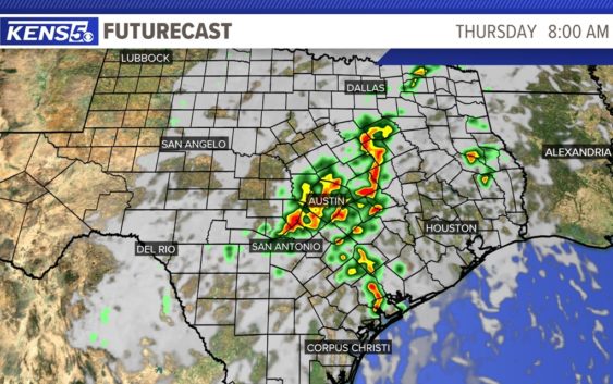
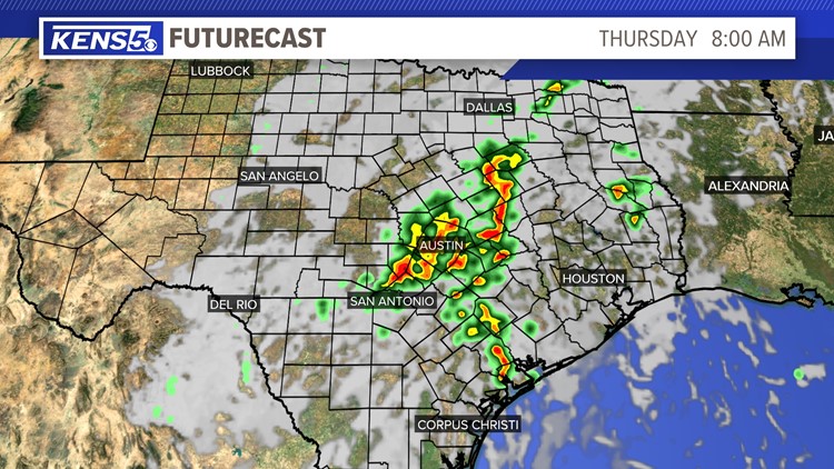
Flood Watch in effect for parts of the Hill Country through Thursday afternoon
SAN ANTONIO — Showers and thunderstorms are expected to continue across portions of the Hill Country overnight through Thursday afternoon.
A Flash Flood Watch is in effect for Bandera, Blanco, Edwards, Burnet, Gillespie, Kendall, Kerr, Llano and Real counties through 1 p.m. Thursday afternoon, according to the National Weather Service.
A moist and unstable airmass is in place and the area continues to receive remnants of a tropical cyclone help produce rainfall totals around 1 to 3 inches. Some isolated spots could receive over 4 inches overnight through Thursday morning.
For those isolated spots where heavy rainfall can occur could lead to an impact for the morning commutes in the Hill Country and along parts of the I-35 corridor.
By Thursday afternoon a drier airmass will move through the area dropping rain chances to around 20 percent. An active weather pattern continues on Friday and drops again for the weekend.