- Carolina Beach is warning of potential King Tide flooding
- NCDEQ launches Hurricane Helene recovery grants program
- Why no hurricanes made landfall in the US in 2025
- Florence to begin interviewing police chief finalists in January
- A West Texas county wants to better prepare for floods. Paying for it will be tricky.
Some flooding, heavy rainfall across Houston anticipated this week
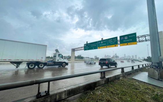
A potential for flooding conditions is in the forecast this week as a days-long rain pattern touched down in Houston Monday morning.
Showers and thunderstorms will span across the Houston area on Monday. Space City Weather predicts that most of the area ranging from Brazos Valley down to Galveston could pick up one to four inches of rainfall by Monday evening. A second round of showers will push through Tuesday morning.
Temperatures are expected to even out around the mid-60s through most of the week, a significant rise from the days-long cold stint that spanned across Houston last week with temperatures dipping into the teens.
Some street flooding is possible with heavy rainfall on Monday, according to National Weather Service Houston, “especially in urban and low-lying areas.”

NWS suggests residents keep up with the latest forecasts available, and have multiple ways to obtain warnings.
Street drains and ditches should be cleared of trash so storm water can flow without issues, Houston Councilman Mario Castillo said in a social media post.
“Blocked drains, ditches and culverts are the most frequent cause of flooding in neighborhoods.”
Some Houston-area school districts were on high alert Sunday evening in anticipation of the heavy rainfall Monday, including Alief and Spring ISD’s, which have since made the call to operate regular Monday schedules while the district monitors potentially bad weather.