- They couldn’t save their daughters’ lives in the July 4 floods. Now they’re dealing with the grief and the guilt.
- Austin could see heavy rains, possible flooding over the next few days
- Families of campers, counselors who died in Texas Hill County floods sue Camp Mystic
- Small plane bound for Jamaica with hurricane relief supplies crashes in Florida neighborhood
- Ask the Meteorologist: Did a tornado hit Johnston County Saturday night?
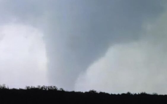
At least 1 tornado touches down in Burnet County as storms pound Central Texas

Reports of damage in Burnet County have begun following a confirmed tornado on Thursday. Central Texas faces another round of storms Friday.
BURNET COUNTY, Texas — Strong storms spawned wild weather across Central Texas on Thursday, including at least one confirmed tornado in Burnet County.
Images from the Oakalla area confirmed a tornado on the ground that was labeled “considerable” at one point, along with reports of grapefruit-sized hail near Lake Buchanan. As of Thursday afternoon, some parts of Burnet County saw anywhere from 2-4 inches of rain.
While it’s unclear how strong the tornado was, Burnet County officials have reported damage along County Road 223, including downed powerlines and debris that has left several areas impassable. Nearly 250 people in Burnet County were also left without power following the storms.
Thursday was just the latest in a string of strong thunderstorms and major hail that slammed Central Texas. Just over a week ago, hail blanketed parts of Georgetown and Round Rock. Hail reported in that storm ranged from golf ball-sized to tennis ball-sized hail.
Despite Thursday’s storms, you can’t put away your umbrellas just yet.
As our weather shifts into a more active pattern, Friday’s storm threat for Central Texas could have a better shot at bringing heavy rain along with damaging winds and another hail risk.
The heaviest rainfall is expected in the afternoon hours of Friday. The flood outlook has much of Central Texas in a 2 out of 4 “slight” risk for excessive rainfall that could lead to flash flooding.
Rain chances are expected to diminish by Friday night, with a front bringing cooler temperatures this weekend. Rain chances are expected to ramp back up by the middle of next week.