- They couldn’t save their daughters’ lives in the July 4 floods. Now they’re dealing with the grief and the guilt.
- Austin could see heavy rains, possible flooding over the next few days
- Families of campers, counselors who died in Texas Hill County floods sue Camp Mystic
- Small plane bound for Jamaica with hurricane relief supplies crashes in Florida neighborhood
- Ask the Meteorologist: Did a tornado hit Johnston County Saturday night?
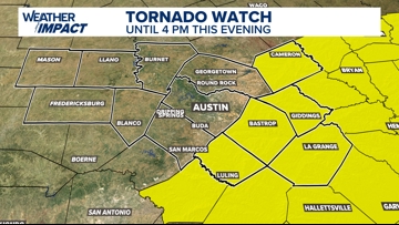
Weather Impact Alert | Tornado Watch in effect for some Central Texas counties, canceled for others
Here’s the latest on timing and primary threats.
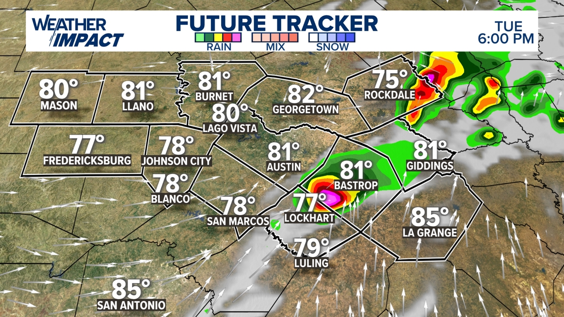
AUSTIN, Texas — *The National Weather Service confirmed a tornado on the ground in Milam County, near Maysfield. The county was under a Tornado Warning that has since expired.*
An active weather pattern is unfolding across Central Texas, and the KVUE Weather Team has issued a Weather Impact Alert through Tuesday. Multiple rounds of storms are expected, with all forms of severe weather possible, including large hail, isolated tornadoes and flooding.
With that being said, not everyone will see heavy rain or severe weather – we just want you to be prepared for some storms that could be severe.

The National Weather Service issued a Tornado Watch Milam, Lee, Bastrop, Caldwell, and Fayette County through 4 p.m. Tuesday. As of 1:35 p.m., that Watch has been canceled for counties in the Interstate 35 corridor.

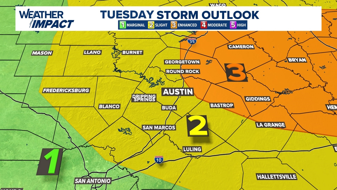
Storms are expected to move west to east through the first half of Tuesday. Tuesday afternoon there will be another window for severe weather late Tuesday.
This second round remains more uncertain and will depend on how much the atmosphere is able to recover. If instability does build back in, isolated supercells may redevelop, particularly east of I-35, with the potential for all types of severe weather.

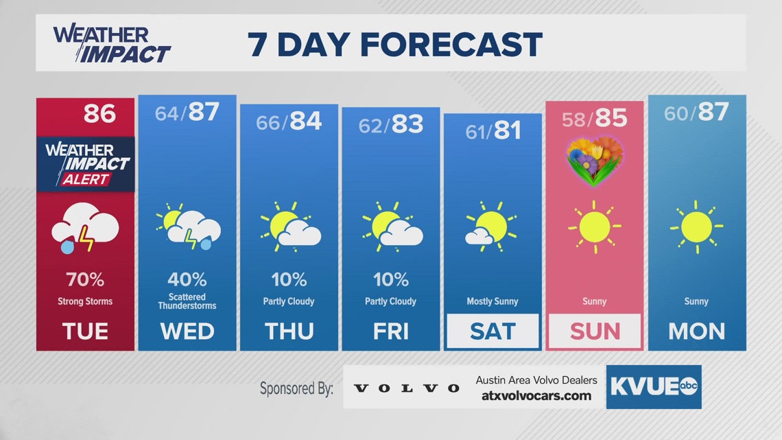
After Tuesday, a few lingering storms are possible on Wednesday, but the forecast trends drier and quieter into late week and the weekend.
The KVUE Weather Team will continue to monitor this evolving forecast closely.
In the meantime, the extended forecast is available below: