- They couldn’t save their daughters’ lives in the July 4 floods. Now they’re dealing with the grief and the guilt.
- Austin could see heavy rains, possible flooding over the next few days
- Families of campers, counselors who died in Texas Hill County floods sue Camp Mystic
- Small plane bound for Jamaica with hurricane relief supplies crashes in Florida neighborhood
- Ask the Meteorologist: Did a tornado hit Johnston County Saturday night?
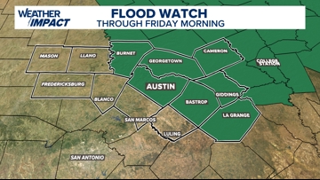
Flood Watch expanded into Central Texas Wednesday; more rainfall incoming
The risk for locally heavy rain and flooding will continue for Central Texas through Wednesday and Thursday.
AUSTIN, Texas — An active weather pattern continues across Central Texas, with multiple rounds of rain and storms expected over the next several days. While the rain is much needed, we’ll also need to watch for the potential of flooding and a low-end severe weather risk.
As of 2 p.m. Wednesday, a Flood Watch has been issued for Burnet, Williamson, Travis, Milam, Bastrop, Lee, and Fayette County until Friday morning.

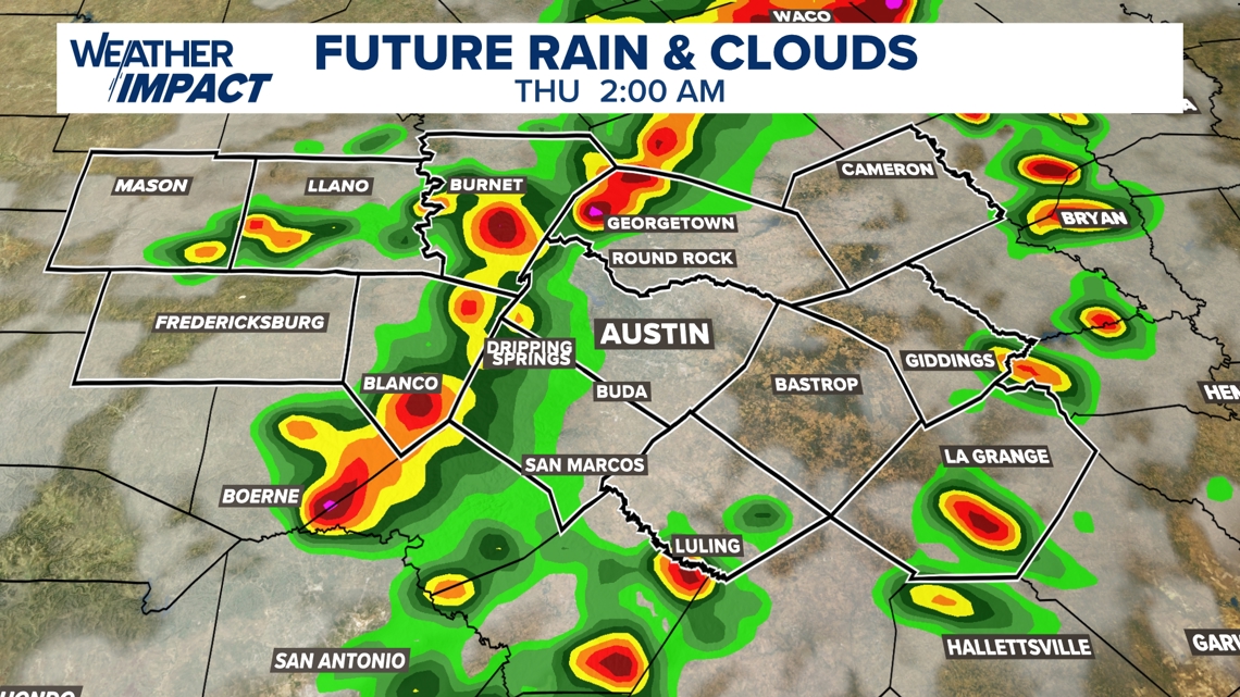
Localized flooding is the main concern as we move through the end of the work week. Slow-moving and training storms may produce high rainfall rates, with quick totals of 2 to 3.5 inches in isolated spots. If you encounter a flooded roadway, remember: turn around, don’t drown.
This first wave of heavy rain and storms should taper off by mid-morning Wednesday, if not sooner, giving the atmosphere time to recharge.
Another round of scattered to widespread storms is possible Wednesday afternoon through Wednesday night, with the heaviest rain likely along and east of Interstate 35. Best confidence in rain fall will again be overnight Wednesday into early Thursday morning.

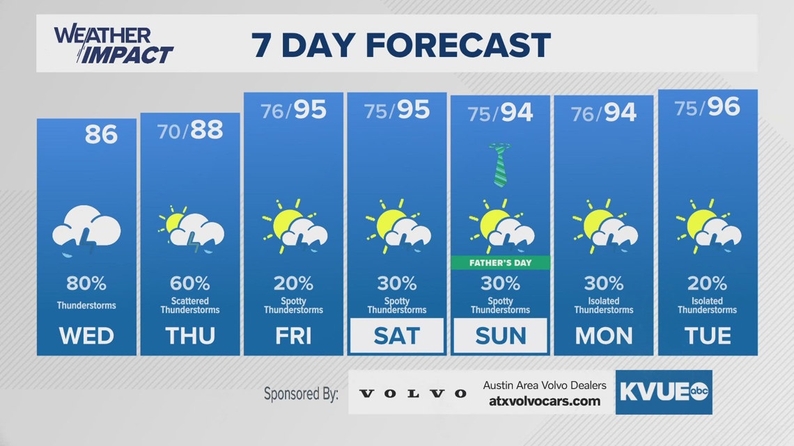
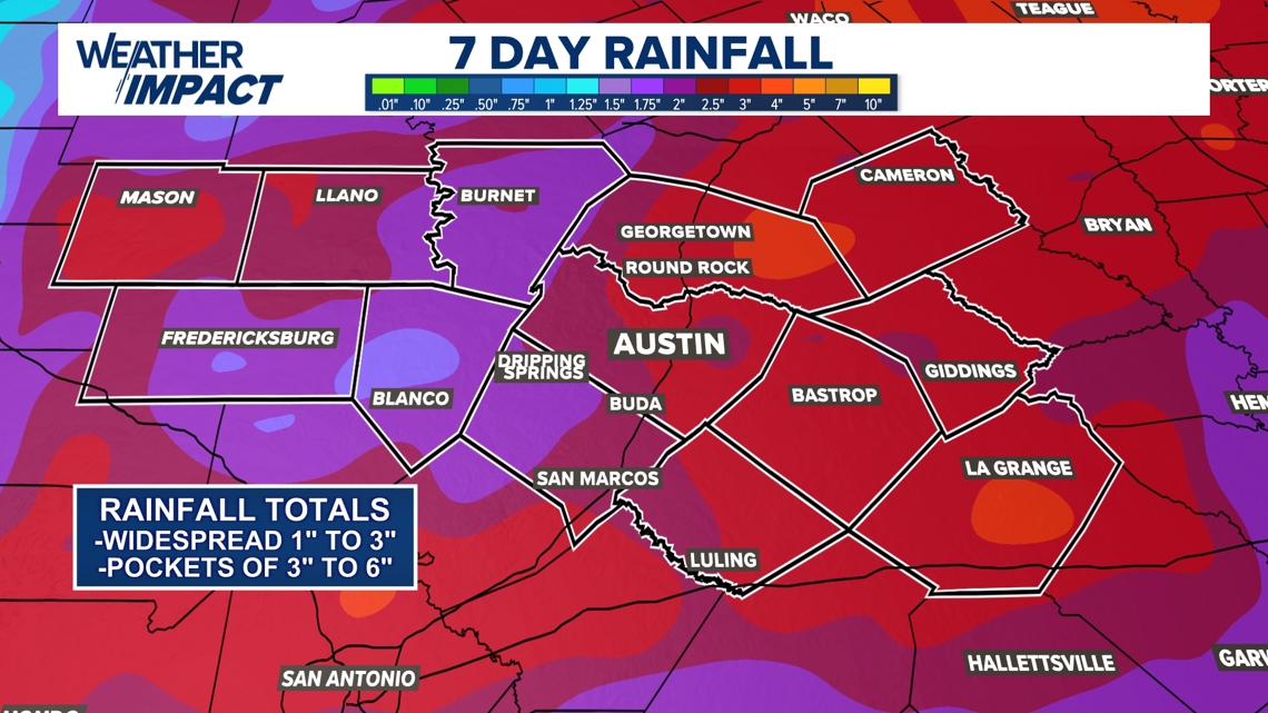
While Friday and the weekend will trend drier, a few hit-or-miss storms may still develop. In total, most areas can expect 1 to 3 inches of rain through the week, with some pockets seeing as much as 6 inches or more. Continue to stay weather-aware and watch for flooding through the rest of the workweek.

The KVUE Weather Team will closely monitor the evolving forecast.
In the meantime, you can find the extended forecast below: