- They couldn’t save their daughters’ lives in the July 4 floods. Now they’re dealing with the grief and the guilt.
- Austin could see heavy rains, possible flooding over the next few days
- Families of campers, counselors who died in Texas Hill County floods sue Camp Mystic
- Small plane bound for Jamaica with hurricane relief supplies crashes in Florida neighborhood
- Ask the Meteorologist: Did a tornado hit Johnston County Saturday night?
A weather pattern primed for flash flooding | Why Central Texas experienced deadly flooding over the Fourth of July weekend
Here’s why the atmospheric setup was so conducive to copious amounts of rain.
AUSTIN, Texas — Extremely heavy rainfall and dangerous flash flooding led to a deadly holiday weekend across Central Texas. With some areas receiving over 20 inches of rain in a timespan of 24 hours, meteorologists are now analyzing the weather pattern that created and allowed such heavy rain to fall over such a short period of time.
Here is the breakdown of what happened.
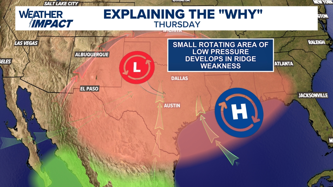
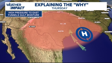
1) Deep moisture from the Gulf
Throughout the days leading up to the Fourth of July, a ridge of high pressure was situation just to the east of Texas, south of Louisiana. With a southeasterly flow coming in on the back side of that high pressure system, Gulf moisture was funneled in from the coast into Central Texas.
This was one out of three moisture sources that led to an incredibly moist atmosphere.

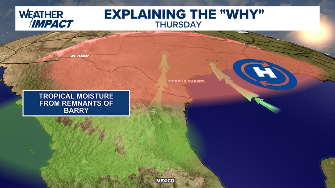
2) Moisture from the remnants of Tropical Depression Barry
Tropical Depression Barry made landfall along the East Mexico coast on June 29. While there were not direct impacts to Central Texas from that tropical system, moisture from those remnants streaming north into Texas during the days ahead of the Fourth of July provided for our second source of deep, tropical moisture that contributed to the fuel for the heavy rainfall and, eventually, flash flooding.

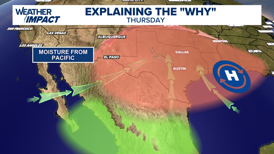
3) Moisture from the Pacific
Our third – and smallest, yet still impactful – source of moisture came from the Pacific.
All three of these moisture sources converged right over Central Texas, leading to near-record available atmospheric moisture for developing storms to tap into. This is what allowed for incredibly high rainfall rates across the region.

3 sources of moisture interacting with a compact, upper-level, rotating low-pressure system
Now that we have established the three sources of moisture, what produced the “lift” to get these storms going?
A Mesoscale Convective Vortex (MCV) had developed in the Lubbock area on Thursday, before dipping south towards Central Texas on Friday and into the weekend. This essentially acted as the energy to force the storms into development.
However, due to very weak steering currents, this small area of low pressure barely moved. In turn, rounds of rain kept redeveloping around the “swirl,” eventually training over some areas across Central Texas, which lead to relentless rain in several spots. And with plenty of moisture available, those rainfall rates were incredibly high.
As these bands sat nearly stationary over a few specific areas, rainfall totals quickly stacked up. All that water over one area during a shortened amount of time, coupled with the porous limestone and sandy nature of our riverbeds, made for a fast-developing and dangerous flash flood set up.