- Austin could see heavy rains, possible flooding over the next few days
- Families of campers, counselors who died in Texas Hill County floods sue Camp Mystic
- Small plane bound for Jamaica with hurricane relief supplies crashes in Florida neighborhood
- Ask the Meteorologist: Did a tornado hit Johnston County Saturday night?
- Demolition begins on flood-damaged homes in Stoney Creek as neighbors await relief
Tropical Storm Imelda shifts away from NC coast, Flooding and rip current risks remain
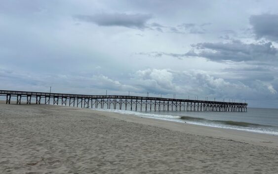
Residents and officials up and down the North Carolina coast are
breathing a sigh of relief as Tropical Storm Imelda shifts course and
is no longer expected to make landfall in the area.
However, concerns remain
high as officials continue to monitor the storm’s potential impacts,
particularly flooding and dangerous rip currents.
Other WRAL Top Stories
Ahead of the weekend, the Town of Ocean Isle Beach took
significant steps to prepare for the worst-case scenario. Mayor Debbie Smith
said that crews worked to ensure the town was ready for whatever Imelda might
bring
“Just gassed up all of our vehicles, checked all of our
generators, and made sure all our pumps were working. Our normal procedures,
pre-hurricane or pre-potential storm event,” said Smith.
While the storm had only begun to pick up by Monday afternoon with
some heavy rain, officials are not letting their guard down.
“We all know hurricanes can be quite unpredictable. We always try
to prepare for the worst and hope for the best. I’ve even seen CAT 1 storms do
unexpected damage, and I’ve seen CAT 3 storms do very little damage. We try to
be prepared for whatever Mother Nature brings us,” said Smith.
Smith said the best way to get updates on the storm from
town officials is on the website and Facebook page.
As of Monday afternoon, Imelda continues to strengthen with maximum sustained winds at 65 mph. WRAL meteorologist Mike Maze said the storm is still moving north, but is expected to turn to the northeast tonight and become a hurricane.
For North Carolina, high rip current risks are likely throughout the week at the coast. The Outer Banks will experience rough surf all week with 6 to 10 foot seas.