- Eric Tulsky comfortable, confident and going for the Stanley Cup in 2nd year as Hurricanes GM
- 5 homes collapse into the surf of the Outer Banks as hurricanes rumble in Atlantic
- As hurricanes pass offshore, more Buxton homes collapse into the sea
- Central Texas floods reveal need to shore up disaster response in unincorporated areas
- Latest: Tropical Storm Imelda will pull away from East Coast, expected to become a hurricane
Live radar: Severe storm threat continues for Central Texas after confirmed tornado in Burnet County
After storms Wednesday evening, additional storm chances await later this week.
AUSTIN, Texas — Updates: A Severe Thunderstorm Watch is in effect until 9 p.m. for most of Central Texas. Check active weather alerts here.
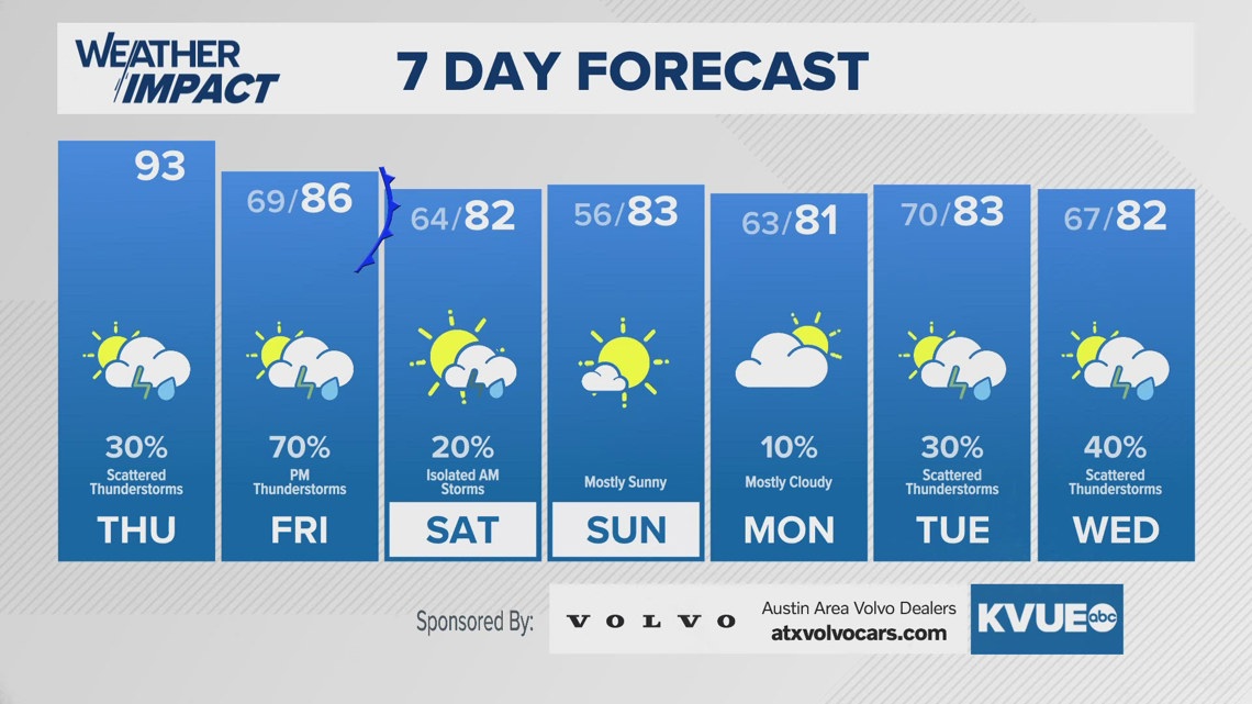
We’ve had an active weather pattern so far this week, and we fully expect that to continue for Thursday evening and on into Friday evening. This is due to moist air sitting right on top of us that’ll stay persistent throughout the course of this week. As a result, we’ve issued Weather Impact Alert Days for both Thursday night as well as Friday.
Here’s what we’re tracking.
What to expect tonight
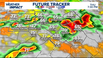
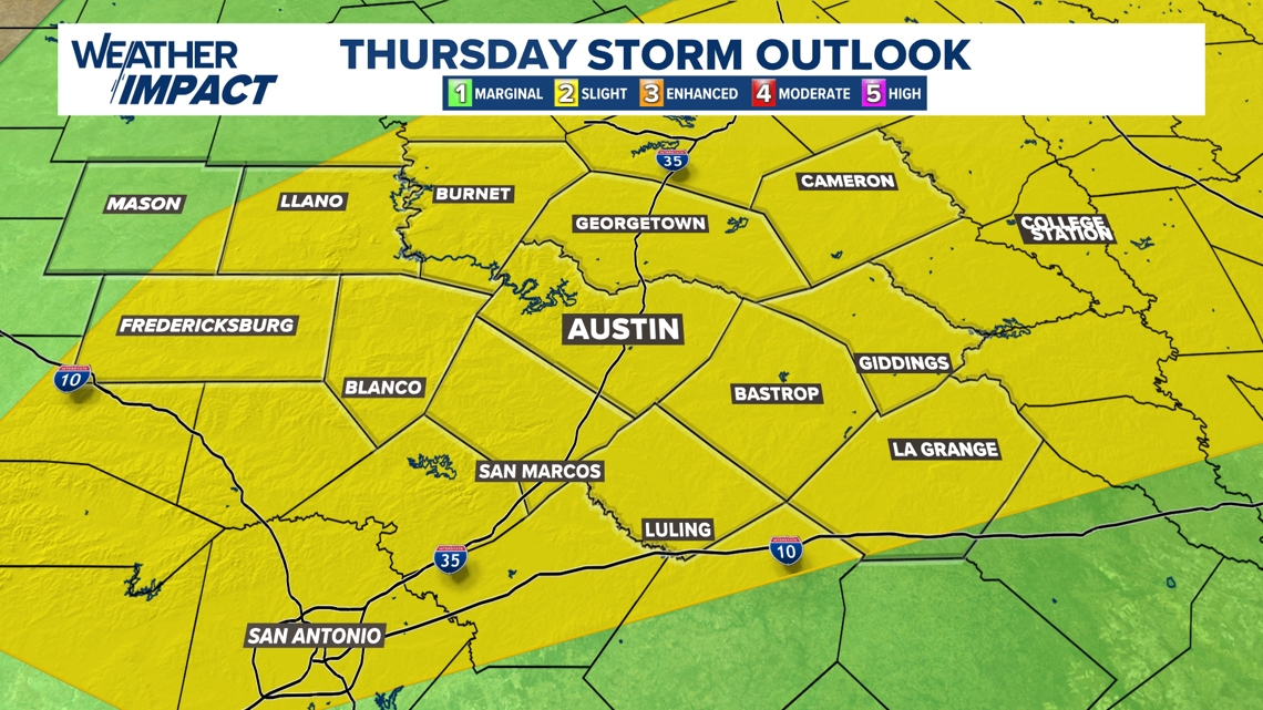
We’re tracking a good storm chance later Thursday evening with many spots under the gun for another good chance for severe weather. The timing of this will be between 5 and 11 p.m. Thursday evening.

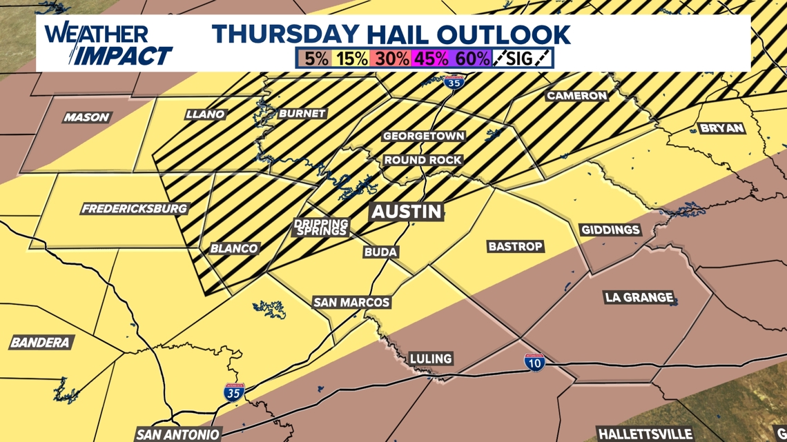
As a result, most of the KVUE area is under a 2 out of 5 “slight” risk for severe weather, with hail being the main threat. There’s a “hatched” area for that, which includes the northern Austin metro area, as well as sections of the Hill Country, as well as Williamson and Milam counties, where hail could get up to near tennis ball sized hail or larger, similar to what was reported near Taylor High School Wednesday evening.

Tonight’s hail outlook

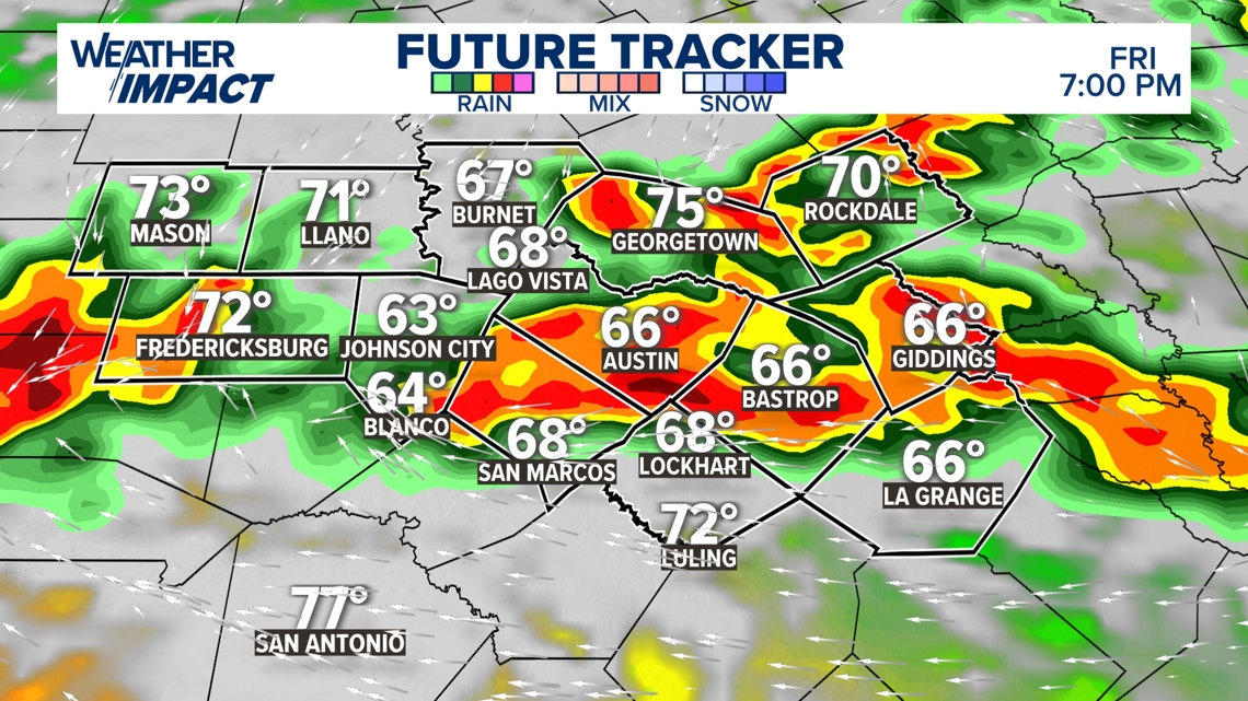
Friday’s storms
While we do have chances for storms Thursday, those chances are widely scattered with Friday having a better shot for more active weather for the afternoon hours as the stationary front inches closer to Central Texas.
The timing of the heaviest rain will mainly be in the afternoon hours, but in addition to the risk of hail and damaging winds, the flood threat will increase due to the accumulated rainfall from previous rounds combined with Friday’s rainfall.
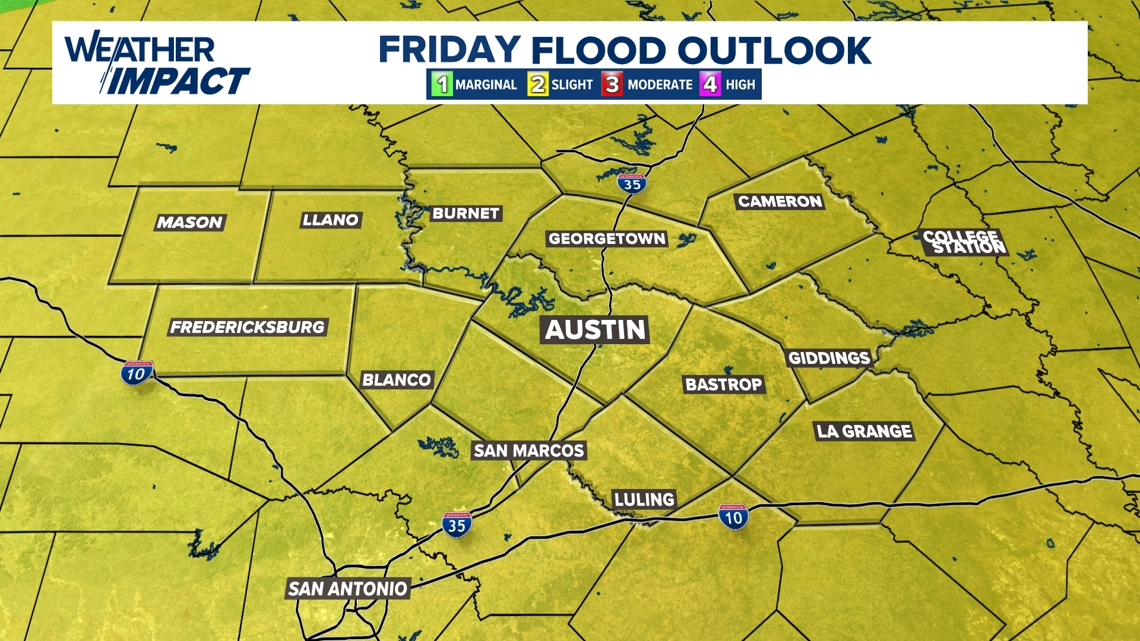
Thus, our flood outlook has all of our KVUE counties in a 2 out of 4 “slight” risk for excessive rainfall that could lead to flash flooding.

Friday flood outlook

By Friday night, rain chances will diminish as the front moves to the south, bringing cooler temperatures for the weekend. Highs will be in the low 80s on both Saturday and Sunday, providing a brief break from the heat. However, the weather pattern remains active, and rain chances are expected to return by the middle of next week.
The KVUE Weather Team will continue to monitor these developments closely. For the latest updates and the extended forecast, be sure to check below.