- They couldn’t save their daughters’ lives in the July 4 floods. Now they’re dealing with the grief and the guilt.
- Austin could see heavy rains, possible flooding over the next few days
- Families of campers, counselors who died in Texas Hill County floods sue Camp Mystic
- Small plane bound for Jamaica with hurricane relief supplies crashes in Florida neighborhood
- Ask the Meteorologist: Did a tornado hit Johnston County Saturday night?
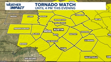
Weather Impact Alert | Tornado Watch in effect Tuesday
Here’s the latest on timing and primary threats.
AUSTIN, Texas — An active weather pattern is unfolding across Central Texas, and the KVUE Weather Team has issued a Weather Impact Alert through Tuesday. Multiple rounds of storms are expected, with all forms of severe weather possible, including large hail, isolated tornadoes and flooding. With that being said, not everyone will see heavy rain or severe weather. We just want you to be prepared for some storms that could be severe.
Early Tuesday morning, the National Weather Service issued a Tornado Watch for all Central Texas counties. This will be in effect through 4 p.m.

Attention now shifts westward, where the next wave of storms is expected to develop overnight. These will begin as isolated supercells west of the KVUE area but may organize into a larger complex or several clusters of storms that move over parts of our region during the late overnight hours into Tuesday morning.
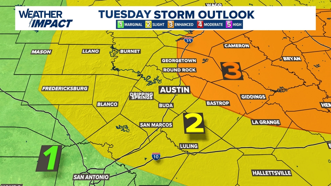
The Storm Prediction Center outlines a “slight” – Level 2 of 5 – severe weather risk for most of the KVUE area. An “enhanced” – Level 3 of 5 – risk has been outlined across the northeast Coastal Plains.

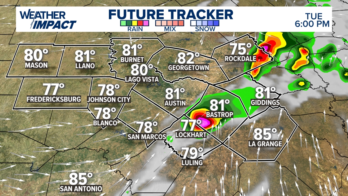
High-resolution model guidance continues to indicate the potential for strong to severe storms impacting the I-35 corridor and the Austin metro during the Tuesday morning commute, generally between 6 a.m. and 9 a.m. Although the model below depicts widespread storms, the coverage could be more spotty in some spots. The overall storm chance is about 70% for Tuesday.


Be sure to check in on the latest forecast before heading out the door in the morning. Large hail, damaging winds, isolated tornadoes and heavy rainfall will all be possible. Storms are expected to move west to east through the first half of Tuesday.
This morning round will occur ahead of a cold front, which is expected to push through the KVUE area during the afternoon and evening. As this happens, there may be another window for severe weather late Tuesday.
This second round remains more uncertain and will depend on how much the atmosphere is able to recover. If instability does build back in, isolated supercells may redevelop, particularly east of I-35, with the potential for all types of severe weather.

After Tuesday, a few lingering storms are possible on Wednesday, but the forecast trends drier and quieter into late week and the weekend.
The KVUE Weather Team will continue to monitor this evolving forecast closely.
In the meantime, the extended forecast is available below:

