- They couldn’t save their daughters’ lives in the July 4 floods. Now they’re dealing with the grief and the guilt.
- Austin could see heavy rains, possible flooding over the next few days
- Families of campers, counselors who died in Texas Hill County floods sue Camp Mystic
- Small plane bound for Jamaica with hurricane relief supplies crashes in Florida neighborhood
- Ask the Meteorologist: Did a tornado hit Johnston County Saturday night?
Large hail, strong winds and tornado threat possible into Thursday evening
The primary threats associated with these storms will be large hail and strong winds along with the usual lightning and heavy rain.
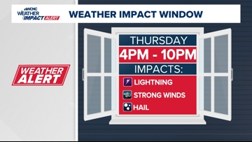
CHARLOTTE, N.C. — WCNC Charlotte’s Weather Impact Team wants everyone in the Charlotte area to be weather alert due to the risk of strong-to-severe thunderstorms Thursday evening.
WCNC Weather Impact Meteorologist Chris Mulcahy said these storms will have the potential for heavy rain, hail, damaging winds and flash flooding. There’s also a chance of an isolated tornado.
When
The first wave of storms is expected to impact the foothills and areas west of Charlotte around 4 p.m. Thursday. Impacted areas include Hickory, Lenoir, Morganton, Newton, Shelby and Valdese.
Mulcahy said the window for severe weather will extend from 4 p.m. until around 10 p.m. for the Charlotte metro area. These storms could linger into the night in some areas.

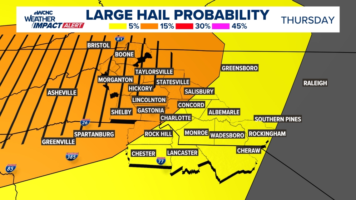
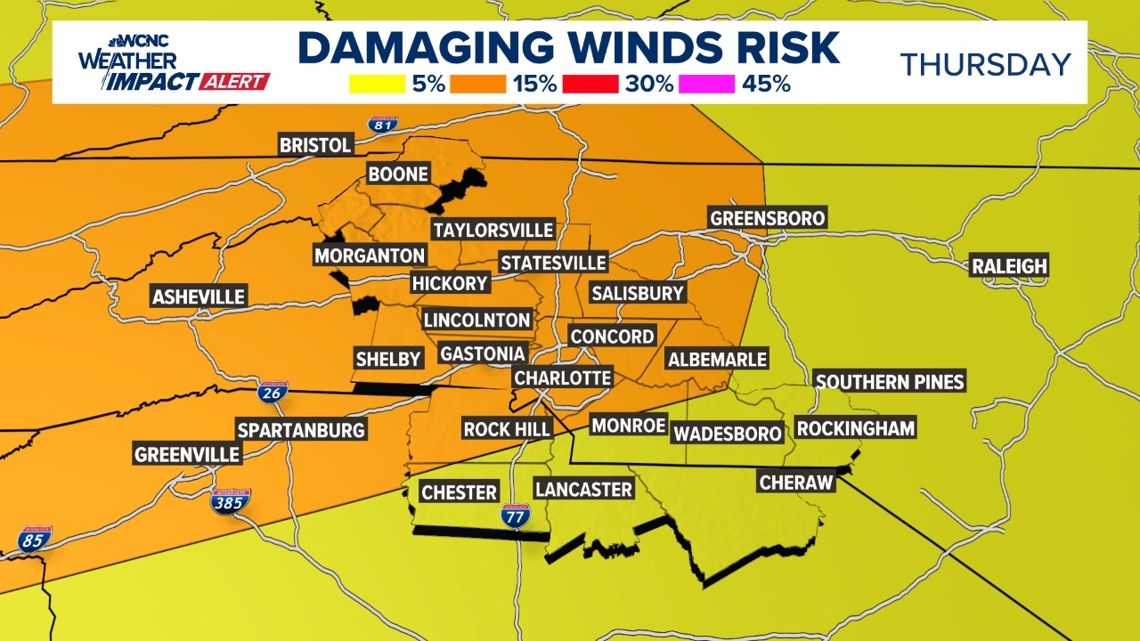
WCNC Weather Impact Chief Meteorologist Brad Panovich said the main threat will be hail and damaging wind gusts. This is an elevated hail risk, with a rare significant hail threat for areas northwest of Charlotte.
Showers are expected to continue overnight into Friday morning, but there’s a much smaller threat for severe weather during Friday’s rain.

NOTE: There is a chance for one more line of storms overnight that is a similar setup to what we had on Saturday night where a weak tornado spun up. This is a low chance with some weak shear, so it is worth mentioning.
Impact
The primary threats associated with these storms will be lightning, heavy rain and strong winds. Some areas in the foothills could also get hail as the front arrives in the late afternoon to evening.

How to stay safe
Have a plan for any outdoor activities, as storms could disrupt any event during this time.
Panovich and the entire Weather Impact team will have regular updates throughout the day on air, on the WCNC Charlotte app and on WCNC+ which you can download on your TV and stream for free 24/7.
Worst places to be during lightning:
- Open fields, on top of a hill
- Near tall, isolated trees
- Near water or metal
Best place to be:
- Inside a car
- Inside a building
Contact Chris Mulcahy at cmulcahy@wcnc.com and follow him on Facebook, X, Instagram and TikTok.
Contact Brad Panovich at bpanovich@wcnc.com or follow him on Facebook, X and Instagram.