- U.S.-based aid groups rush to get supplies into storm-battered Jamaica after Hurricane Melissa
- Travelers stuck in Jamaica due to Hurricane Mellissa forced to pay for unwanted extended stay
- Raleigh police officer awaits word from family in Jamaica after Hurricane Melissa devastation
- North Carolina’s leaders give insight on the effects of Hurricane Melissa
- ‘We want some answers;’ Whiteville residents demand city response to prevent flooding
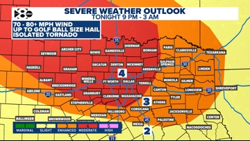
DFW Weather: Significant severe weather moving into North Texas tonight, including damaging winds, golf ball size hail
We’re tracking another round of intense storms that will bring widespread damaging winds.
DALLAS — Watch live radar and regular forecast updates from our meteorologists on our Smart TV streaming app WFAA+ and download the WFAA mobile app for alerts from our weather team as they come.
Daily rain chances are in the forecast this week. Some see higher coverage and a strong storm threat. Here’s the latest forecast:
Key points
- Severe weather is likely tonight
- More thunderstorms next week… not as severe
- Weekend: Unsettled Pattern Continues
LIVE Radar
The best chance for storms looks to arrive tonight. That’s when we’ll be watching for another round of intense storms that could bring widespread damaging winds. Sunday is a WFAA Weather Alert Day (from 9 p.m. to 3 a.m.)
THE LATEST FROM OUR WEATHER TEAM
TONIGHT
As mentioned above, our best chance for severe storms this weekend will be tonight. A complex of thunderstorms will race out of western Oklahoma and the panhandle of Texas and bring a damaging wind risk with it. Winds could exceed 70-80MPH in some instances. Here’s an idea of the timing.

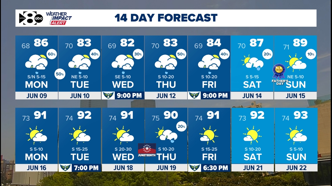
14-day Forecast
By Sunday night into early next week, we could see a cold front drop into North Texas. That would help spark more rain and storm chances on both Monday and Tuesday — so don’t put the umbrella away just yet!
We’ll keep you updated on any severe threats.