- They couldn’t save their daughters’ lives in the July 4 floods. Now they’re dealing with the grief and the guilt.
- Austin could see heavy rains, possible flooding over the next few days
- Families of campers, counselors who died in Texas Hill County floods sue Camp Mystic
- Small plane bound for Jamaica with hurricane relief supplies crashes in Florida neighborhood
- Ask the Meteorologist: Did a tornado hit Johnston County Saturday night?
Weather Impact Alert: 'Flash Flood Emergency' issued as heavy rains continue Saturday
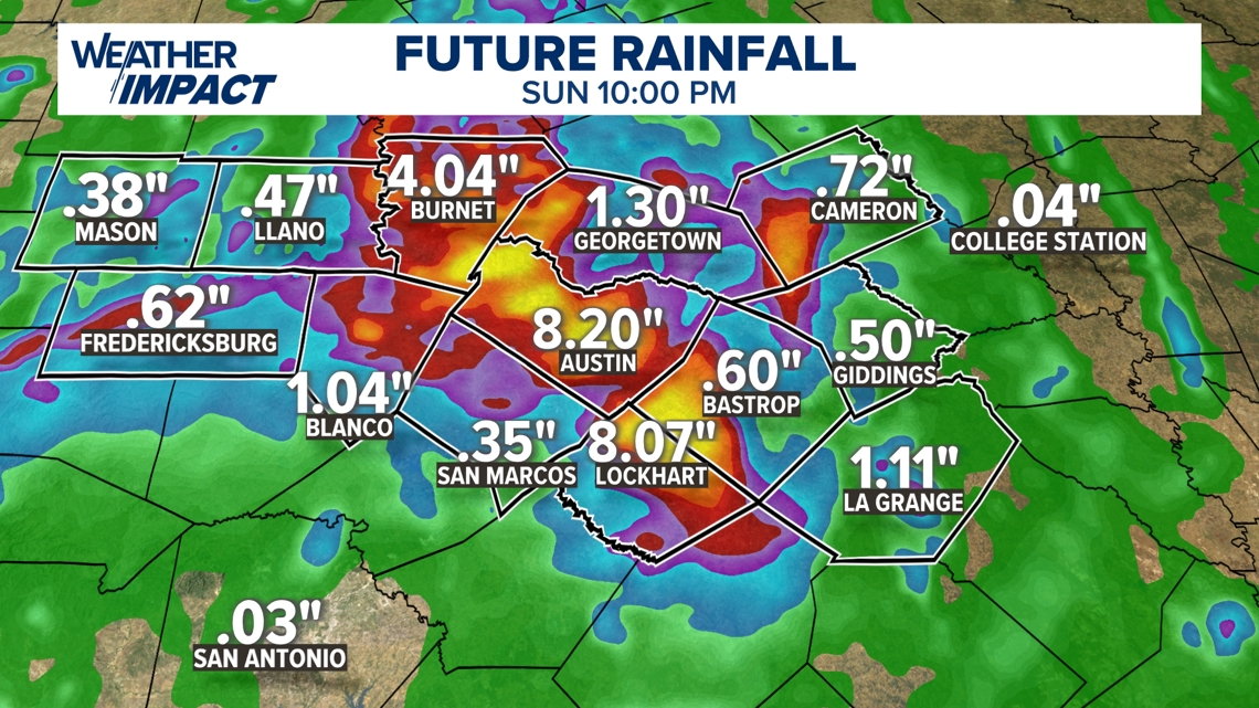
Many areas could see an additional 4 to 5 inches of rain.
AUSTIN, Texas — We’ve had a significant weather event this weekend, with heavy rain and flooding in Burnet County early Saturday morning.
At least 25 water rescues have taken place, and State Highway 29 and U.S. 281 both have become impassable due to flooding.
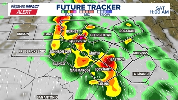
Our Future Tracker shows widespread rain activity, with some areas seeing intense downpours. A Flash Flood Warning is in effect for Travis County until 2 p.m. Saturday.

When all is said and done, many areas could see an additional 4 to 5 inches of rain, and we’ll really watch those creeks and streams for any rapid rises.

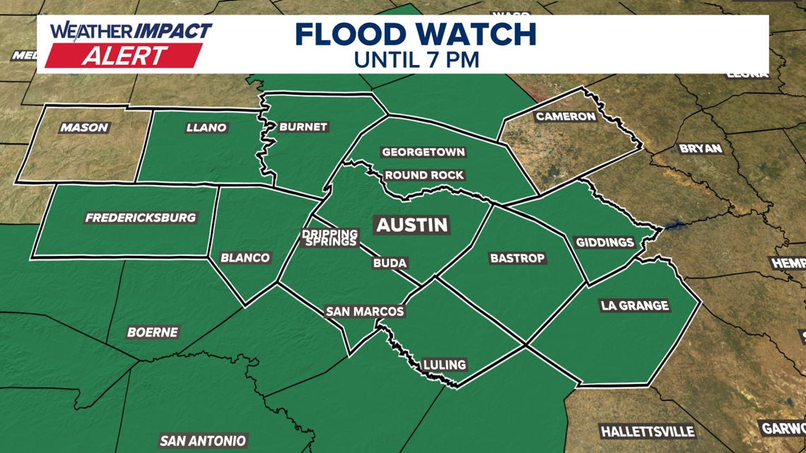
Given the expected heavy rainfall, a Flood Watch has been issued for a wide area until 7 p.m. This includes Austin, San Marcos, Bastrop and many surrounding communities. Remember, a Flood Watch means conditions are favorable for flooding, so it’s crucial to stay vigilant.

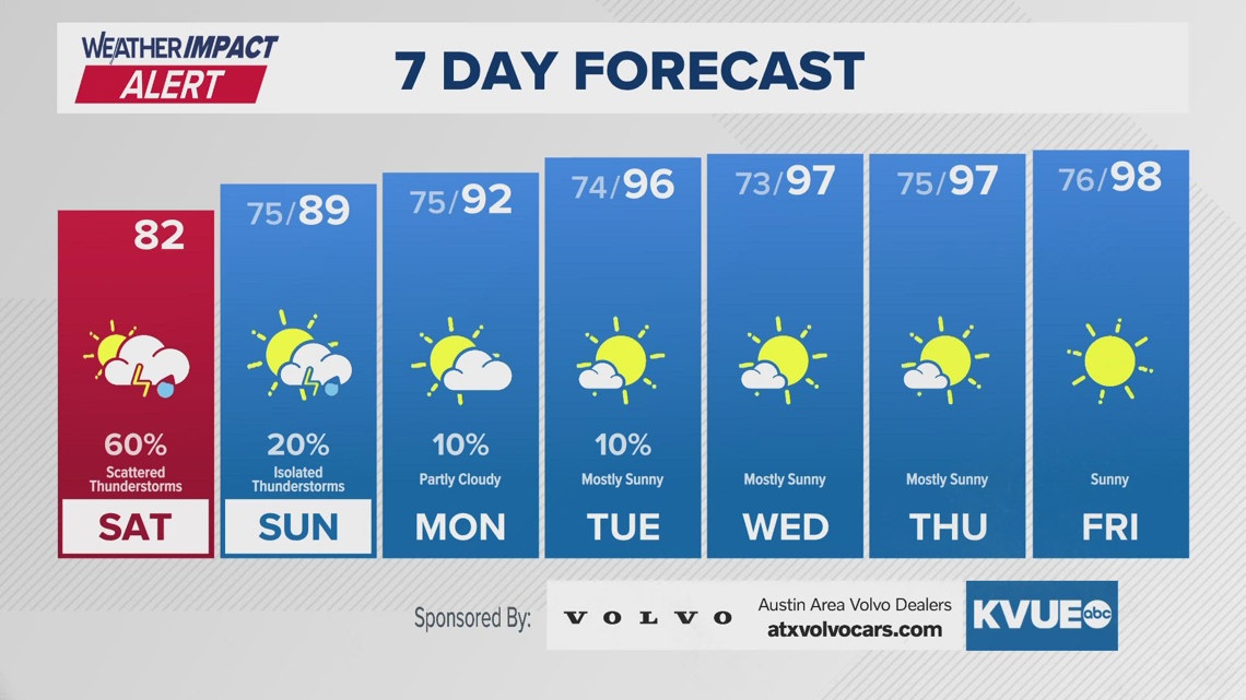
Looking beyond Saturday, the forecast shows a gradual improvement in conditions. While Sunday still carries a chance of isolated thunderstorms, the rest of the week is looking mostly sunny with temperatures climbing into the high 90s and even hitting 100 degrees by Thursday.
Stay safe out there and remember to never drive through flooded roads. Turn around, don’t drown!