- They couldn’t save their daughters’ lives in the July 4 floods. Now they’re dealing with the grief and the guilt.
- Austin could see heavy rains, possible flooding over the next few days
- Families of campers, counselors who died in Texas Hill County floods sue Camp Mystic
- Small plane bound for Jamaica with hurricane relief supplies crashes in Florida neighborhood
- Ask the Meteorologist: Did a tornado hit Johnston County Saturday night?
What alerts did NWS send ahead of deadly flash floods in Texas? Here's a timeline of events
After the flood occurred, officials faced questions about whether and when authorities sent out weather alerts and warnings before the deadly flash flooding.
DALLAS — A devastating sequence of events unfolded across the Texas Hill Country early Friday, culminating in a flash flood emergency and river levels not seen in years.
Kerr County authorities, alongside state and federal officials, said Sunday morning that search-and-rescue teams had recovered at least 68 bodies so far, including 28 children. More than 800 people had been rescued as of Sunday morning, as fellow Texans look to assist through donation drives and online funds.
Forty-eight hours after the flood occurred, officials faced questions about whether and when authorities sent out weather alerts and warnings before the deadly flash flooding.
Here’s how the situation developed with the forecasts and alerts sent out by the National Weather Service:
Tuesday through Thursday morning
Early Forecasts
Meteorologists with the National Weather Service offices in San Antonio and Austin began highlighting the potential for flooding as early as Tuesday. By Thursday morning, the messaging had intensified, with forecasters warning of the increasing risk of flash flooding and river rises.
1:18 p.m. Thursday
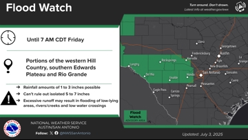
Flood Watch Issued Through Friday Morning
The National Weather Service officially issued a Flood Watch that included Kerr County, highlighting the potential for up to 7 inches of rain.

6:10 p.m. Thursday
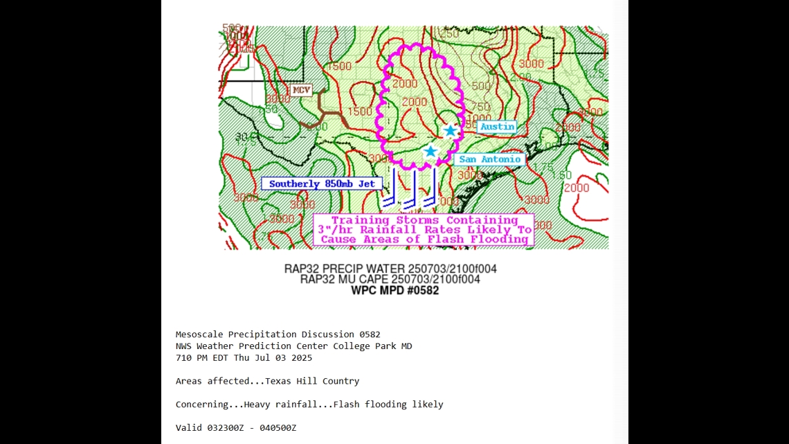
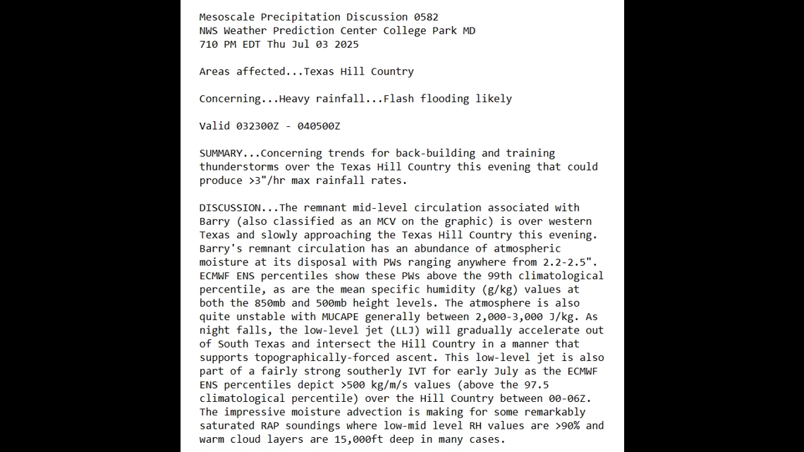
Special Weather Discussion Issued
A rare special weather discussion emphasized worsening trends. Forecasters noted:
- “Concerning trends”
- “Flash flooding likely”
- “Rainfall rates exceeding 3 inches per hour”


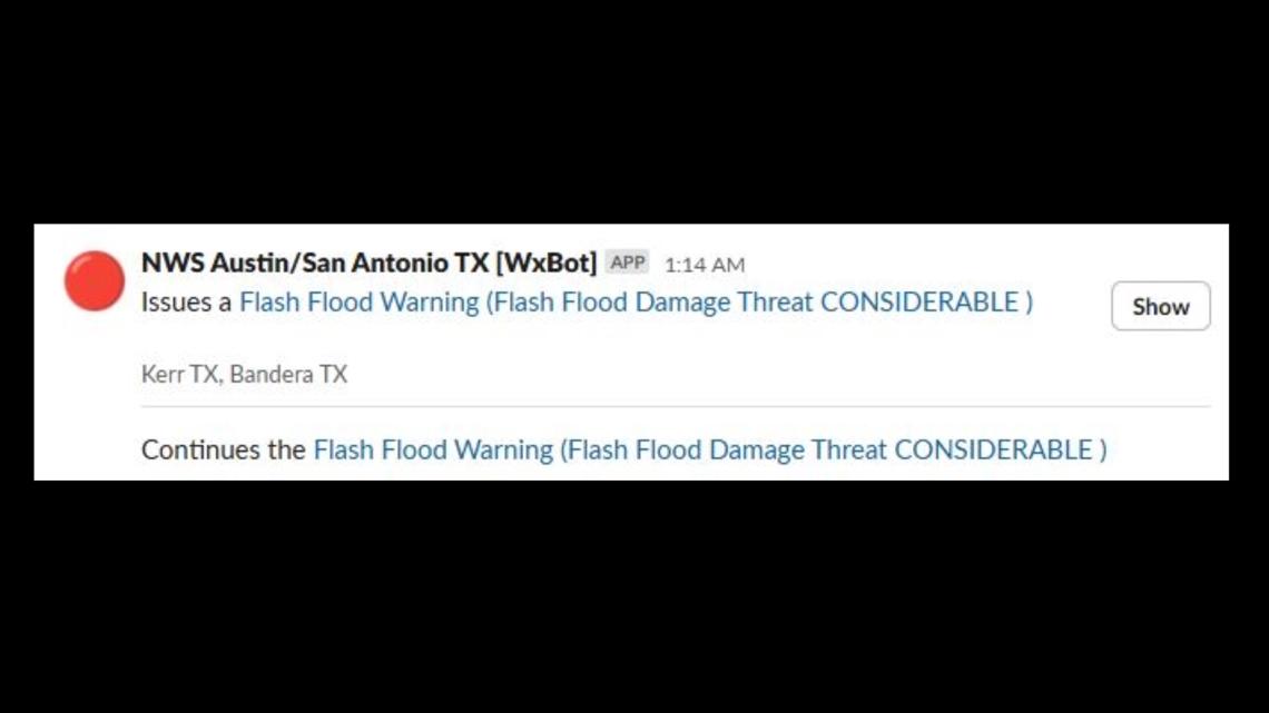
1:14 a.m. Friday
Flash Flood Warning Issued for Kerr County
The first official warning came just after 1 a.m. with a “Considerable” tag. This tag is reserved for significant and potentially life-threatening flash floods and typically triggers Wireless Emergency Alerts on mobile phones across the region. It’s currently unclear how cellular coverage in the area may have impacted people’s ability to receive the alert.

2:28 a.m. Friday
Flash Flood Communication Update
In the National Weather Service Chat, The NWS reported that up to 5 inches of rain had already fallen. Conditions in Kerr County suggested that flash flooding had already begun.
3:02 a.m. Friday
Flash Flood Situation Worsens
In a subsequent communication, the NWS warned that a “dangerous flash flood event is unfolding in south-central Kerr County.”
4:03 a.m. Friday
Flash Flood Emergency Declared for Kerr County

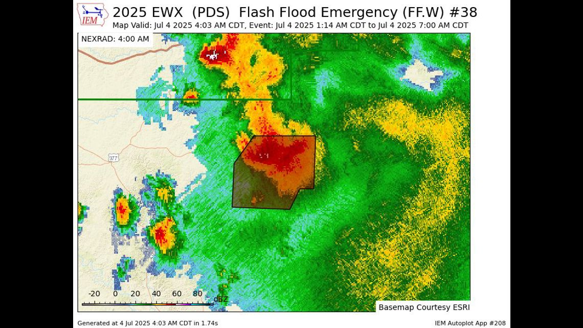
A rarely issued Flash Flood Emergency was declared — the most serious alert level in the flash flood warning system. This designation is reserved for only the most life-threatening and catastrophic flooding events. Only a small percentage of warnings reach this level.
4:20 a.m. Friday
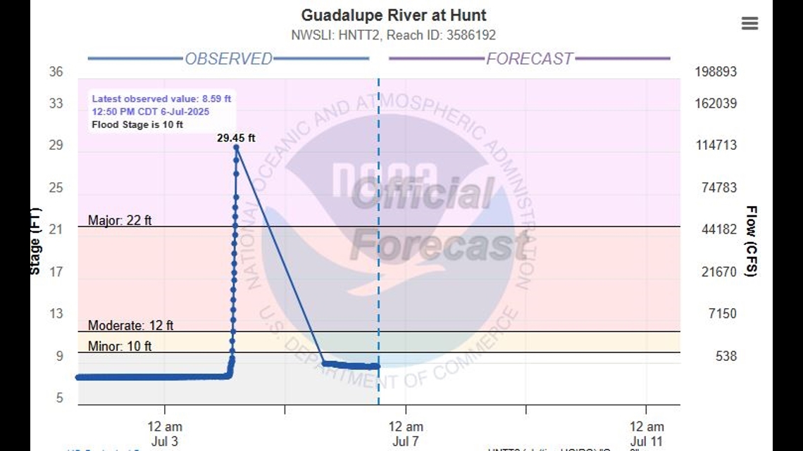
Guadalupe River Reaches Major Flood Stage
Near Hunt, Texas, the Guadalupe River surged past its major flood stage of 22 feet, eventually cresting at an astounding 29.45 feet at 4:35 AM. The speed and magnitude of the rise are stunning.