- They couldn’t save their daughters’ lives in the July 4 floods. Now they’re dealing with the grief and the guilt.
- Austin could see heavy rains, possible flooding over the next few days
- Families of campers, counselors who died in Texas Hill County floods sue Camp Mystic
- Small plane bound for Jamaica with hurricane relief supplies crashes in Florida neighborhood
- Ask the Meteorologist: Did a tornado hit Johnston County Saturday night?
As Austin Braces For Historic Flooding, Here Are 8 Ways To See What’s Ahead.
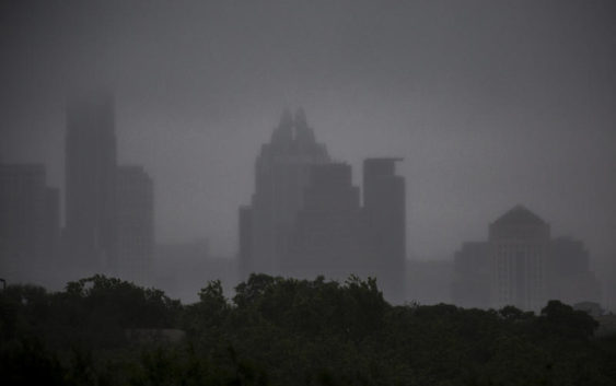
Persistent rains and historic flooding have moved through the Austin and the greater Central Texas area this week.
To keep you up-to-date, we’ve collated a list of resources to turn to during severe weather.
Google Crisis Map
Google’s map can alert you to any weather-related warnings or watches in your area, as well as display public shelter locations.
National Weather Service Radar And Emergency Website
Check the map below for updates on low-water crossing closures in Central Texas.
LCRA Hydromet Rainfall Totals
Check the LCRA’s Hydromet to see rainfall totals across the Austin area and flood conditions for creeks around the city. You can find more rain gauge and creek flood conditions for the entire Lower Colorado River basin here.
Check Lake Levels And Flood Status
Check water levels at the Highland Lakes on LCRA’s flood status page, and see how upstream flows are impacting Lake Travis, Lake Austin and Lady Bird Lake.
Texas Flood Conditions
Track statewide flood conditions with this map from the Texas Water Development Board.
Austin Energy Outage Map
Check for reported outages in Austin Energy’s service area and view power restoration estimates.
Customers of other electricity providers in Central Texas can find outage reports, too:
Severe Weather Twitter List
We’ve compiled a list of useful Twitter accounts to follow for the latest info on weather and flood conditions, road closures and other emergency information.
This post has been updated.