- They couldn’t save their daughters’ lives in the July 4 floods. Now they’re dealing with the grief and the guilt.
- Austin could see heavy rains, possible flooding over the next few days
- Families of campers, counselors who died in Texas Hill County floods sue Camp Mystic
- Small plane bound for Jamaica with hurricane relief supplies crashes in Florida neighborhood
- Ask the Meteorologist: Did a tornado hit Johnston County Saturday night?
Thunderstorm Warning In Effect; Large Hail And High Winds Possible Into Early Morning

Severe weather is beginning to move through the Austin area.
There’s a severe thunderstorm warning for parts of the Hill Country until 11:45 p.m.
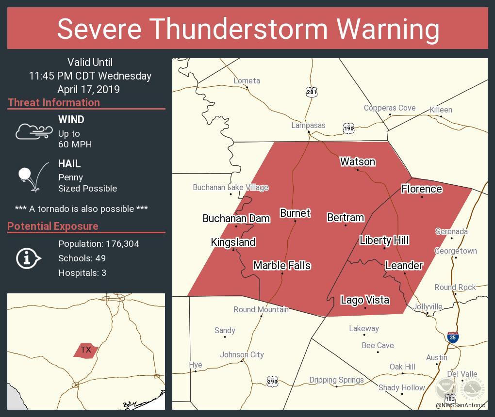
The National Weather Service has issued a severe thunderstorm watch until 2 a.m. for much of the Austin area and the Hill Country.
Large hail and damaging winds are the most likely threats facing the area.
The weather service puts the chance of precipitation for Austin at 90 percent tonight, with between one-half and three-quarters of an inch of rain possible.
The National Weather Service in Austin/San Antonio tweeted a forecast model showing the brunt of the storms hitting Austin between 11 p.m. and 1 a.m. — noting the actual time and intensity of the storm’s arrival may change.
RELATED | 8 Ways To Stay Ahead Of Severe Weather In Central Texas
Eric Platt, a meteorologist with the National Weather Service, says the storm will develop out over the Hill Country and come in from the west.
“The hail and the high winds are the biggest concerns at this time, although we can certainly expect frequent cloud-to-ground lightning strikes and some heavy rain as this line of storms moves through the region,” Platt said.
Thursday is expected to be sunny with a high near 74 degrees.