- They couldn’t save their daughters’ lives in the July 4 floods. Now they’re dealing with the grief and the guilt.
- Austin could see heavy rains, possible flooding over the next few days
- Families of campers, counselors who died in Texas Hill County floods sue Camp Mystic
- Small plane bound for Jamaica with hurricane relief supplies crashes in Florida neighborhood
- Ask the Meteorologist: Did a tornado hit Johnston County Saturday night?
FORECAST: Severe weather threat Thursday
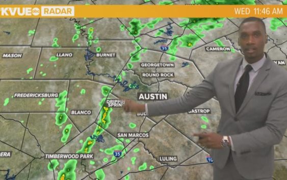
AUSTIN, Texas — Weather Outlook
An isolated lingering shower is possible this evening. Partly cloudy skies tonight with patchy fog and drizzle developing after midnight. A front will move into the area tomorrow afternoon allowing for scattered thunderstorms to develop. A few storms could be strong or severe, with large hail and damaging winds being the primary threats. Dangerous heat this weekend with surface temperatures in the upper 90s and heat index values at or above 105 degrees.
RELATED: Severe storms possible Thursday afternoon in Central Texas
DETAILED FORECAST:
TONIGHT:
A 20% chance of an isolated lingering shower this evening; partly cloudy skies later tonight. East wind shifting to the southwest at 5 mph.
LOW: 74°
TOMORROW:
Patchy morning fog. Mostly cloudy skies with a 60% chance of showers and thunderstorms, some could be strong or severe. Northwest wind 5 to 10 mph.
HIGH: 91°
FRIDAY:
Mix of clouds and sun with a 20% chance of an isolated shower. Hot and humid with temperatures in the mid-90s. Northwest wind 5 to 10 mph.
HIGH: 96°
RELATED: Allergy Report
Stay with KVUE on social media and download the KVUE News app so you can stay ahead of the storm. kvue.com/app