- Tropical Storm Melissa brings flood risk to Haiti, Dominican Republic and Jamaica
- Army Corps evaluates Wrightsville Beach storm damage; could accelerate re-nourishment plans
- Austin and Travis County issue disaster declaration as wildfire risk rises
- Raleigh rethinks how to grow as flooding, heat and traffic worsen
- New legislative panels will investigate ‘facts and circumstances’ of deadly Central Texas floods
Severe storm triggers flash flood emergency around New Orleans ahead of tropical weather
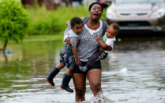
NEW ORLEANS, Louisiana — A tropical weather system was expected Wednesday to develop into a storm that could push the already swollen Mississippi River precariously close to the tops of levees that protect New Orleans.
The low pressure area was over water, south of the Florida Panhandle early Wednesday and was expected to strengthen into a storm as it moved west through the Gulf’s warm waters.
Forecasters say parts of Louisiana could see up to 12 inches of rain by Monday, with heavier amounts possible in some spots.
Mississippi and Texas were also at risk of torrential rains.
The National Weather Service said New Orleans is protected to a river level of 20 feet, but it was forecast to rise above flood stage to 19 feet by Friday.
Though much of the heaviest rain isn’t expected until the weekend, the broad area of disturbed weather in the Gulf was already producing strong thunderstorms over Louisiana on Wednesday. Those storms prompted tornado and flash flood warnings Wednesday morning in the New Orleans area. The weather service said up to 3 inches (7.6 centimeters) of rain had fallen in the area.
RELATED: Hurricane predicted to make landfall this weekend | Houston is in the cone
Copyright © 2019 by The Associated Press. All Rights Reserved.