- Families of campers, counselors who died in Texas Hill County floods sue Camp Mystic
- Small plane bound for Jamaica with hurricane relief supplies crashes in Florida neighborhood
- Ask the Meteorologist: Did a tornado hit Johnston County Saturday night?
- Demolition begins on flood-damaged homes in Stoney Creek as neighbors await relief
- NC Office of State Fire Marshal aiding in Hurricane Melissa relief efforts
Texas flooding: Imelda among wettest tropical cyclones to hit US
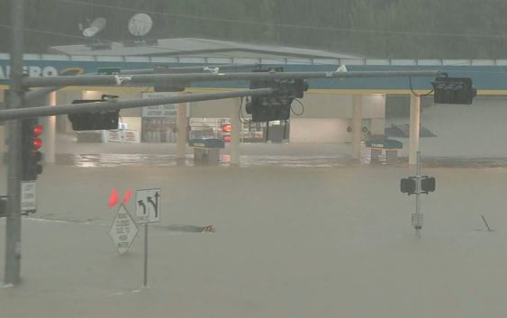
The National Weather Service says Imelda is the seventh-wettest tropical cyclone to strike the 48 contiguous United States on record.
Meteorologist Michael Marcotte of the weather service office in Lake Charles, Louisiana, says Imelda is also the fourth-wettest to strike Texas on record. He cited information provided on Thursday by the National Weather Service Weather Prediction Office in College Park, Maryland.
The National Weather Service on Thursday evening allowed flash flood warnings to expire for the Houston area, replacing them with a flash flood watch. That’s after reporting a 9.18-inch official rainfall reading for Thursday at Bush Intercontinental Airport. That is a record daily rainfall for September in Houston and ranks fifth all-time.
The heaviest rain unleashed on Houston by Hurricane Harvey was 16.07 inches on Aug. 27, 2017, the second day it rained on the city.
Copyright © 2019 by The Associated Press. All Rights Reserved.