- Families of campers, counselors who died in Texas Hill County floods sue Camp Mystic
- Small plane bound for Jamaica with hurricane relief supplies crashes in Florida neighborhood
- Ask the Meteorologist: Did a tornado hit Johnston County Saturday night?
- Demolition begins on flood-damaged homes in Stoney Creek as neighbors await relief
- NC Office of State Fire Marshal aiding in Hurricane Melissa relief efforts
Heavy Rain Increases Chance For Flash Flooding Across North Texas
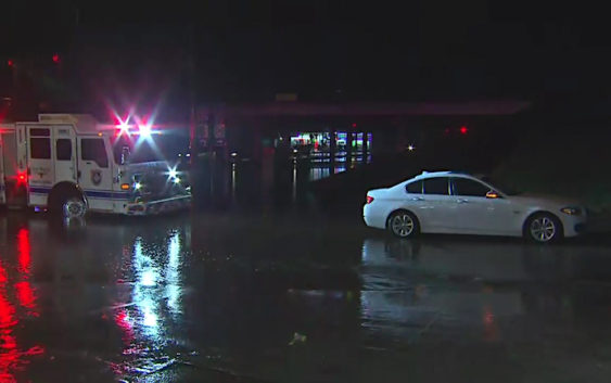
NORTH TEXAS (CBSDFW.COM) – While the risk for severe weather is slim, heavy rain is causing ponding on roadways and flash flooding in some parts.
The National Weather Service issued a Flash Flood Warning from just after 6:30 a.m. until 8:00 a.m.
Problems along streets and highways had already been a problem the warning was issued.
Police and firefighters in Fort Worth spent part of the morning blocking off the intersection at Rosedale and Loop 820. At least one driver had to be rescued after their car flooded in high water. No one was injured.
Dallas Fire Rescue was also busy before sunrise. Several cars became trapped on Mockingbird Lane, near the south end of Love Field Airport, and had to be rescued. The high water left one car stranded with their flashers on, but everyone got out safely.
Dallas Area Rapid Transit (DART) issued an alert to expect delays on the Red and Orange lines due to a signal problem. Passengers had to board shuttle buses between Spring Valley and the LBJ/Central stations.
At one point more than 5,000 residents across North Texas were without power because of the storms.