- Flood watch in effect for the Austin area from noon Sunday until noon on Monday
- A Texas congressman is quietly helping Elon Musk pitch building $760M tunnels under Houston to ease flooding
- TribCast: How will Texas protect its campers from future floods?
- San Antonio Zoo to disburse 20,000 complimentary tickets to folks affected by Texas floods
- Hurricane Erin leaves rough seas with 2 swimmers dead and a search underway for a missing boater
Potential for rain, severe weather as two fronts impact NC
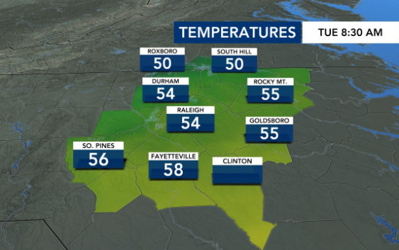
Raleigh, N.C. — Unsettled weather is keeping the Triangle on its toes this week. Highs reach the 70s. Lows reach the 20s. Rain and potentially severe storms march across the state.
Tuesday’s morning commute was a bit foggy and rainy, causing potential for visibility issues and slower traffic. Temperatures will warm up to the high 60s Tuesday afternoon as the rain begins to taper off.
However, another front developing in the west threatens to bring severe storms on Wednesday. The band of rain and storms could reach the Triangle around 5 p.m. Wednesday, possibly impacting the evening commute. The Triangle is under a level 1 severe threat risk as a result of the approaching system.

Before the storms arrive, Wednesday’s temperatures rise all the way up into the 70s. Behind the storms, however, cold air comes filtering back through — bringing overnight lows crashing back down into the 20s and 30s for the weekend.

Weekend highs could be in the 40s, bringing cool, but sunny days.
It starts to warm up again by next Monday, but along with the warmth comes the rain — a common cycle that the Triangle has become quite familiar with recently.