- A Texas congressman is quietly helping Elon Musk pitch building $760M tunnels under Houston to ease flooding
- TribCast: How will Texas protect its campers from future floods?
- San Antonio Zoo to disburse 20,000 complimentary tickets to folks affected by Texas floods
- Hurricane Erin leaves rough seas with 2 swimmers dead and a search underway for a missing boater
- Parts of Highway 12 along Outer Banks remain closed, days after Hurricane Erin
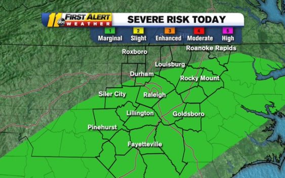
North Carolina remains under a Category 1 risk for severe weather as rain moves out

Remnants from the severe storms and deadly tornado that slammed Tennessee overnight will drift toward North Carolina, but the effects here aren’t expected to be nearly as serious.
“The threat of severe weather is pretty much nonexistent,” Chief Meteorologist Chris Hohmann said Tuesday afternoon.
Most of the ABC11 viewing area was under a Category 1 ‘marginal’ risk for severe weather as the rain moved in. Rain will continue to spread east Tuesday afternoon into the early evening.
By 6 p.m., the rain should be moving out of the Triangle and head eastward.
The storms spawned multiple tornadoes in Nashville and surrounding areas in central Tennessee. The storms have since weakened significantly.
Showers are expected to end in the viewing area in the early evening, making for a quiet end to Tuesday.
Click here for First Alert Doppler XP
Click here to view the latest weather advisories.
Click here for the latest weather forecast.
Copyright © 2020 WTVD-TV. All Rights Reserved.