- U.S.-based aid groups rush to get supplies into storm-battered Jamaica after Hurricane Melissa
- Travelers stuck in Jamaica due to Hurricane Mellissa forced to pay for unwanted extended stay
- Raleigh police officer awaits word from family in Jamaica after Hurricane Melissa devastation
- North Carolina’s leaders give insight on the effects of Hurricane Melissa
- ‘We want some answers;’ Whiteville residents demand city response to prevent flooding
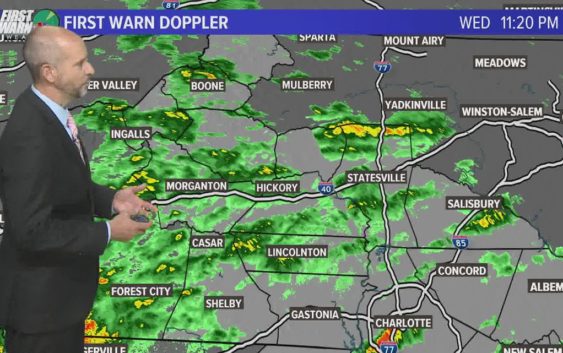
Heavy rain leads to flooding in parts of the Carolinas
A Flash Flood Watch is in effect for portions the entire region: Across the Piedmont and upstate South Carolina through Thursday morning.
CHARLOTTE, N.C. — Periods of heavy rain are still moving across the Carolinas with the threat for flooding along rivers and lakes, especially in the mountains and foothills of North Carolina.
A potentially life-threatening flood event is unfolding Wednesday and Thursday across North Carolina and South Carolina, including in Charlotte.
A Flash Flood Watch is in effect for portions the entire region: Across the Piedmont and upstate South Carolina through Thursday morning.
Be notified of Flash Flood Warnings in your area: Download the WCNC news or weather app to receive severe weather notifications for your location.
Drivers should be aware of the following highwater/ flood alerts:
CABARRUS CO
-Barrier Rd
-Hahn Scott Rd
US 52 closed in both direction at W Main St
Old Hwy 74 near US 74
Ridge Rd near Unionville Indian Trail Rd
W Lawyers Rd between Indian Trail Fairview Rd & Friendly Baptist Church Rd
W Duncan Rd near Howey Bottoms Rd
Sardis Church Rd near Cannon Dr
New Town Rd near Twelve Mile Creek Rd
Shannon Rd between Waxhaw Indian Trail Rd S & Pleasant Grove Rd
***Per NCDOT: all reported to be blocked until 1p***
WATAUGA CO
Guy Ford Rd bridge (near TN state line)
Hubert Thomas Rd bridge (near Boone)
Dewitt Barnett Rd bridge (low severity incident)