- Eric Tulsky comfortable, confident and going for the Stanley Cup in 2nd year as Hurricanes GM
- 5 homes collapse into the surf of the Outer Banks as hurricanes rumble in Atlantic
- As hurricanes pass offshore, more Buxton homes collapse into the sea
- Central Texas floods reveal need to shore up disaster response in unincorporated areas
- Latest: Tropical Storm Imelda will pull away from East Coast, expected to become a hurricane
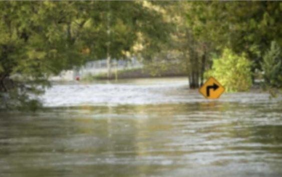
RIVER FLOODING: Florence to rewrite records
Florence looks to rewrite the record books in terms of flooding in the Lower Cape Fear Region. (Source: WECT)
Rainfall of one to two and locally three feet from Hurricane Florence will bring extensive, long-lasting, and in some cases record-setting river flooding across southeastern North Carolina. As feared, flooding will occur in some areas that have never had flooding before.
HERE IS WHAT WE KNOW ABOUT THE LARGER, WELL-MODELED RIVERS…

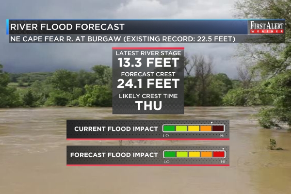
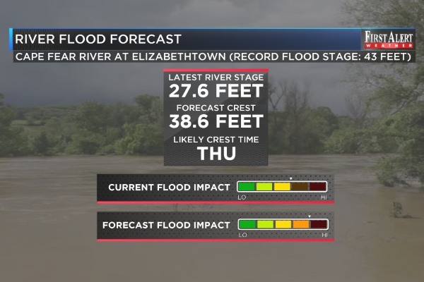

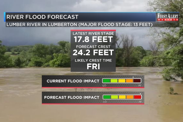
WE KNOW LESS ABOUT THE MANY SMALLER RIVERS AND STREAMS, BUT… rainfall tallies and other storm-related and pre-existing conditions suggest flooding will assume a character as bad or worse than that of Hurricanes Floyd and Matthew. Rivers that fit this mold include, but are not limited to, the Waccamaw, the Shallotte, the Lockwood Folly, the Black, the Brunswick, and Town Creek. An interactive river stage interface is available at http://water.weather.gov.
PLEASE HEED THE ADVICE OF EMERGENCY OFFICIALS and, if and when you are told to evacuate a river flood zone, do so.
PLEASE BE PATIENT IN TRAVEL as river flooding is likely to significantly interrupt roads and other infrastructure across the Cape Fear Region.
Copyright 2018 WECT. All rights reserved.