- U.S.-based aid groups rush to get supplies into storm-battered Jamaica after Hurricane Melissa
- Travelers stuck in Jamaica due to Hurricane Mellissa forced to pay for unwanted extended stay
- Raleigh police officer awaits word from family in Jamaica after Hurricane Melissa devastation
- North Carolina’s leaders give insight on the effects of Hurricane Melissa
- ‘We want some answers;’ Whiteville residents demand city response to prevent flooding
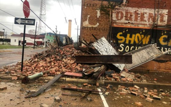
Hurricane Laura moves over Louisiana, leaving destruction in its wake
Share on Facebook
Tweet on Twitter
(CBS News) — “Extremely dangerous” Hurricane Laura made landfall overnight near Cameron, Louisiana, bringing “catastrophic storm surge, extreme winds and flash flooding” to portions of the state, the National Hurricane Center said early Thursday.
The storm had intensified rapidly into a Category 4 hurricane before slamming into the Gulf Coast near the Louisiana-Texas border.
The storm is now moving north, bringing damaging winds and flooding rainfall over central and northern Louisiana, according to forecasters.
As of mid-Thursday morning, the storm was weakening, with winds near 75 mph. The hurricane is expected to become a tropical storm within the next few hours before becoming a tropical depression, according to the hurricane center.
Forecasters said, however, that high water levels are persisting along the Gulf Coast. Tornadoes are possible through Thursday night in parts of Louisiana, Arkansas and Mississippi.