- Families of campers, counselors who died in Texas Hill County floods sue Camp Mystic
- Small plane bound for Jamaica with hurricane relief supplies crashes in Florida neighborhood
- Ask the Meteorologist: Did a tornado hit Johnston County Saturday night?
- Demolition begins on flood-damaged homes in Stoney Creek as neighbors await relief
- NC Office of State Fire Marshal aiding in Hurricane Melissa relief efforts
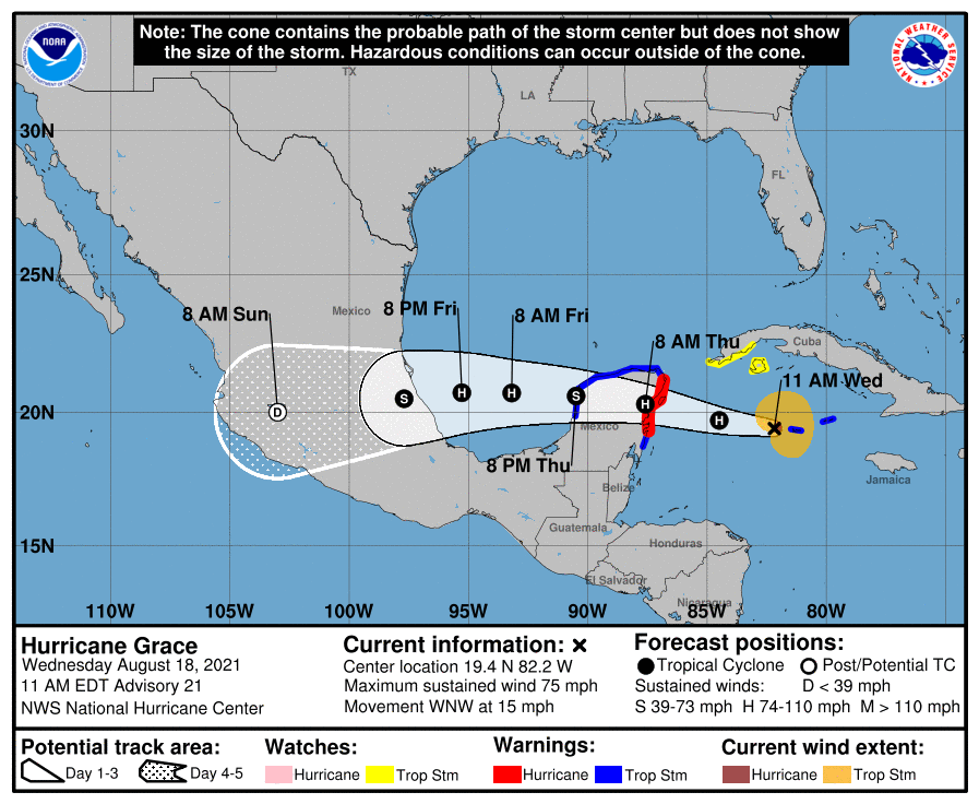
Hurricane Grace on the move in the Gulf of Mexico: Track the storm, possible impacts

Hurricane Grace is no longer a tropical storm as of Friday morning, and a hurricane warning is in effect for the coast of mainland Mexico from Puerto Veracruz to Cabo Rojo.
Hurricane Grace has maximum sustained winds of 85 mph, according to an advisory issued at 7 a.m. from the National Hurricane Center.
The center of Grace is forecast to move across the southwestern Gulf of Mexico Friday. It is expected to make landfall along the coast of mainland Mexico this evening or tonight. After landfall, Grace should weaken rapidly as it moves into the mountains of central Mexico.
Tropical-storm-force winds extend 150 miles from center.
Grace is located 235 miles east of Tuxpan, Mexico, and is moving west at 15 mph.
Cone of uncertainty: See the latest graphic from the NHC
Satellite images: See latest satellite image from NOAA, for a clearer picture of the storm’s size
Latest data on Grace
Here is the latest data on Tropical Storm Grace pulled from the National Hurricane Center’s 4 a.m. advisory.
- Location: 235 miles east of Tuxpan, Mexico
- Maximum sustained winds: 85 mph
- Movement: west at 15 mph
- Pressure: 983 MB (millibars)
- When next advisory will be released: 10 a.m.